MyTopo
Valentine South Nebraska US Topo Map
Couldn't load pickup availability
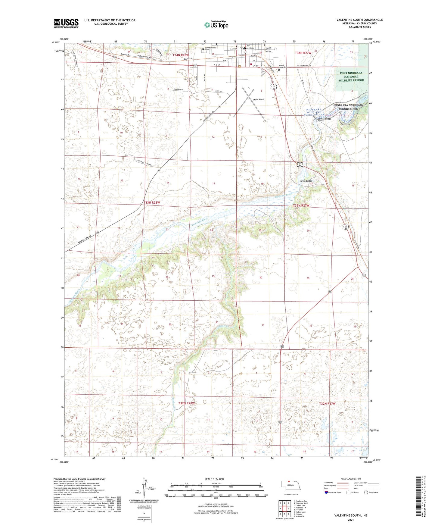
2021 topographic map quadrangle Valentine South in the state of Nebraska. Scale: 1:24000. Based on the newly updated USGS 7.5' US Topo map series, this map is in the following counties: Cherry. The map contains contour data, water features, and other items you are used to seeing on USGS maps, but also has updated roads and other features. This is the next generation of topographic maps. Printed on high-quality waterproof paper with UV fade-resistant inks.
Quads adjacent to this one:
West: Valentine SW
Northwest: Crookston East
North: Valentine North
Northeast: Cornell Dam
East: Thatcher
Southeast: Arabia NW
South: Ell Lake
Southwest: Hudson Lake
This map covers the same area as the classic USGS quad with code o42100g5.
Contains the following named places: Borman Bridge, Borman Bridge Wildlife Management Area, Bryan Bridge, Bryan Bridge Historical Marker, Bryan Bridge Scenic Overlook, Centennial Hall, Cherry County Fairgrounds, Cherry County Historical Society Museum, Colburn Park, Evangelical Free Church, First Baptist Church, Fort Niobrara Historical Marker, Fort Niobrara Trail, Grace Eve Lutheran School, Grace Lutheran Church, Heth Ranch, KVSH-AM (Valentine), Littles Trailer Court, Miller Field, Minnechaduza Cemetery, Mount Hope Cemetery, Our Savior Lutheran Church Missouri Synod, Schlagel Creek, Schlagel School, School Number 21, Sweetheart Trailer Court, Valentine, Valentine Election Precinct, Valentine KOA Campground, Valentine Middle School, Valentine Motel and RV Park, Valentine Post Office, Valentine Trailhead Park, Valentine Visitors Center, Valentine Volunteer Fire Department, Zion Lutheran Church Wisconsin Synod, Zion Lutheran School