MyTopo
Twin Buttes Nebraska US Topo Map
Couldn't load pickup availability
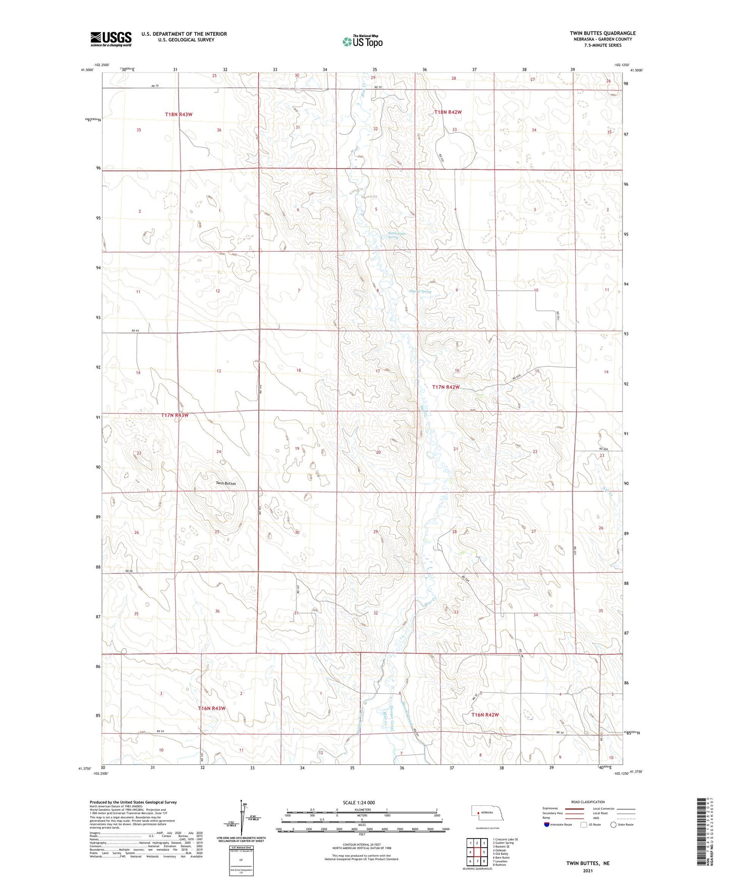
2021 topographic map quadrangle Twin Buttes in the state of Nebraska. Scale: 1:24000. Based on the newly updated USGS 7.5' US Topo map series, this map is in the following counties: Garden. The map contains contour data, water features, and other items you are used to seeing on USGS maps, but also has updated roads and other features. This is the next generation of topographic maps. Printed on high-quality waterproof paper with UV fade-resistant inks.
Quads adjacent to this one:
West: Oshkosh
Northwest: Crescent Lake SE
North: Gusher Spring
Northeast: Rackett SE
East: Old Baldy
Southeast: Ruthton
South: Lewellen
Southwest: Barn Butte
This map covers the same area as the classic USGS quad with code o41102d2.
Contains the following named places: Bluewater Battlefield Overlook Site, Delatour Ranch, Dugout Spring, Jackson-Paisley-Robinson Dam, Jackson-Paisley-Robinson Reservoir, Lobner Group Dam, Lobner Group Reservoir, Olson Ranch, Paisley Canal, Rattlesnake Spring, Twin Buttes