MyTopo
Dannebrog Nebraska US Topo Map
Couldn't load pickup availability
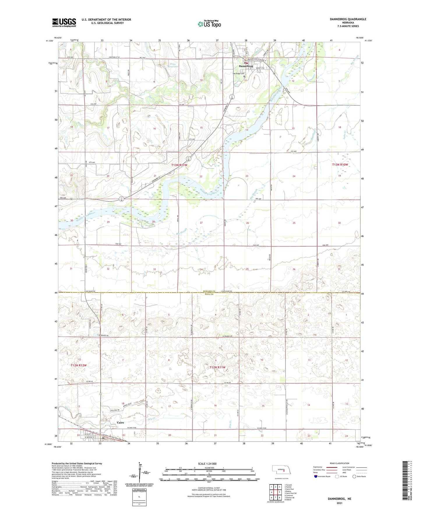
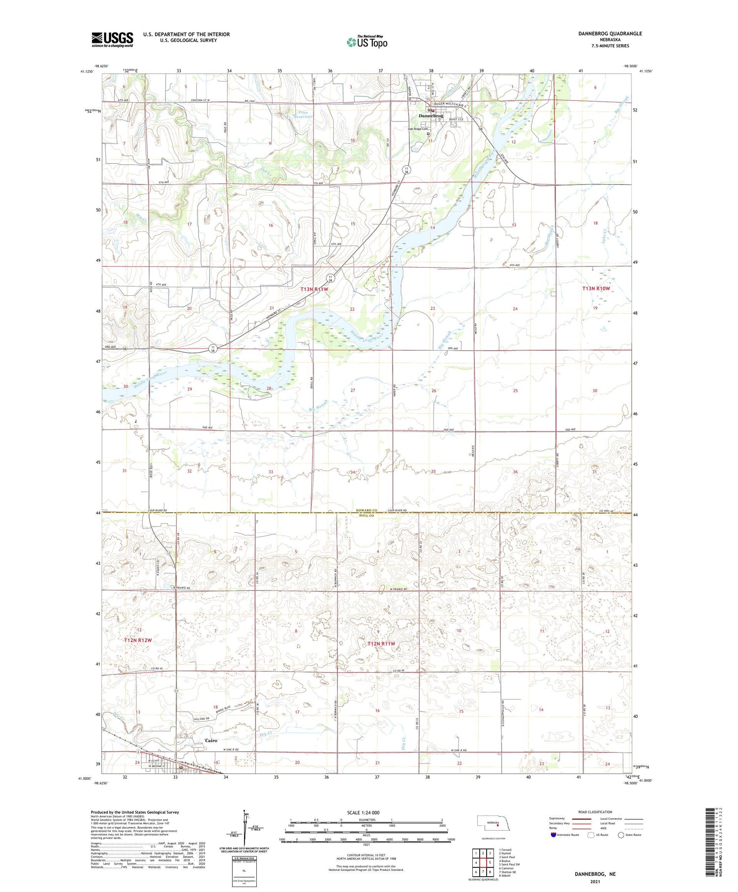
2021 topographic map quadrangle Dannebrog in the state of Nebraska. Scale: 1:24000. Based on the newly updated USGS 7.5' US Topo map series, this map is in the following counties: Howard, Hall. The map contains contour data, water features, and other items you are used to seeing on USGS maps, but also has updated roads and other features. This is the next generation of topographic maps. Printed on high-quality waterproof paper with UV fade-resistant inks.
Quads adjacent to this one:
West: Boelus
Northwest: Farwell
North: Nysted
Northeast: Saint Paul
East: Saint Paul SW
Southeast: Abbott
South: Shelton NE
Southwest: Cameron
This map covers the same area as the classic USGS quad with code o41098a5.
Contains the following named places: Cairo, Cairo Post Office, Cairo United Methodist Church, Centura Hills Golf Club, Centura Public Schools, Christ Lutheran Church, Cleveland Election Precinct, Dannebrog, Dannebrog Election Precinct, Dannebrog Golf Course, Dannebrog Park, Dannebrog Post Office, Dannebrog Public Library, Dannebrog Trails, Dannebrog Volunteer Fire and Rescue, Dry Creek, First Baptist Church, Fries Dam, Fries Reservoir, National Liars Hall of Fame, New Hope Christian Elementary School, Oak Creek, Oak Ridge Cemetery, Our Saviors Lutheran Church, Saint Peders Evangelical Church, School Number 31, School Number 59, School Number 61, School Number 70, School Number 74, School Number 9, Township of Cleveland, Township of Dannebrog, Township of Mayfield, Village of Cairo, Village of Dannebrog, ZIP Code: 68831