MyTopo
Dead Mans Creek Nebraska US Topo Map
Couldn't load pickup availability
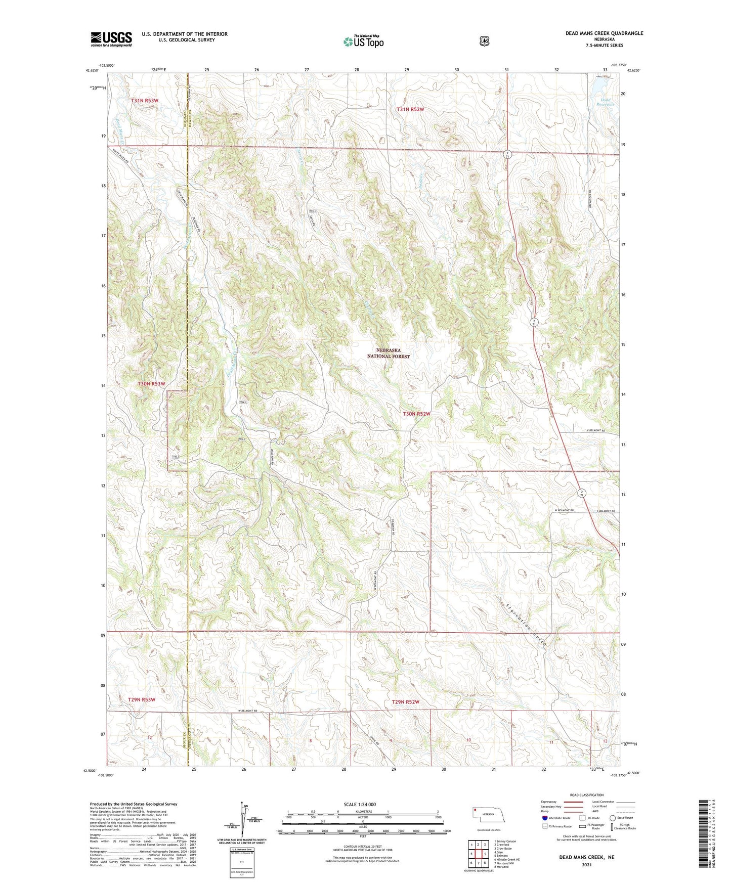
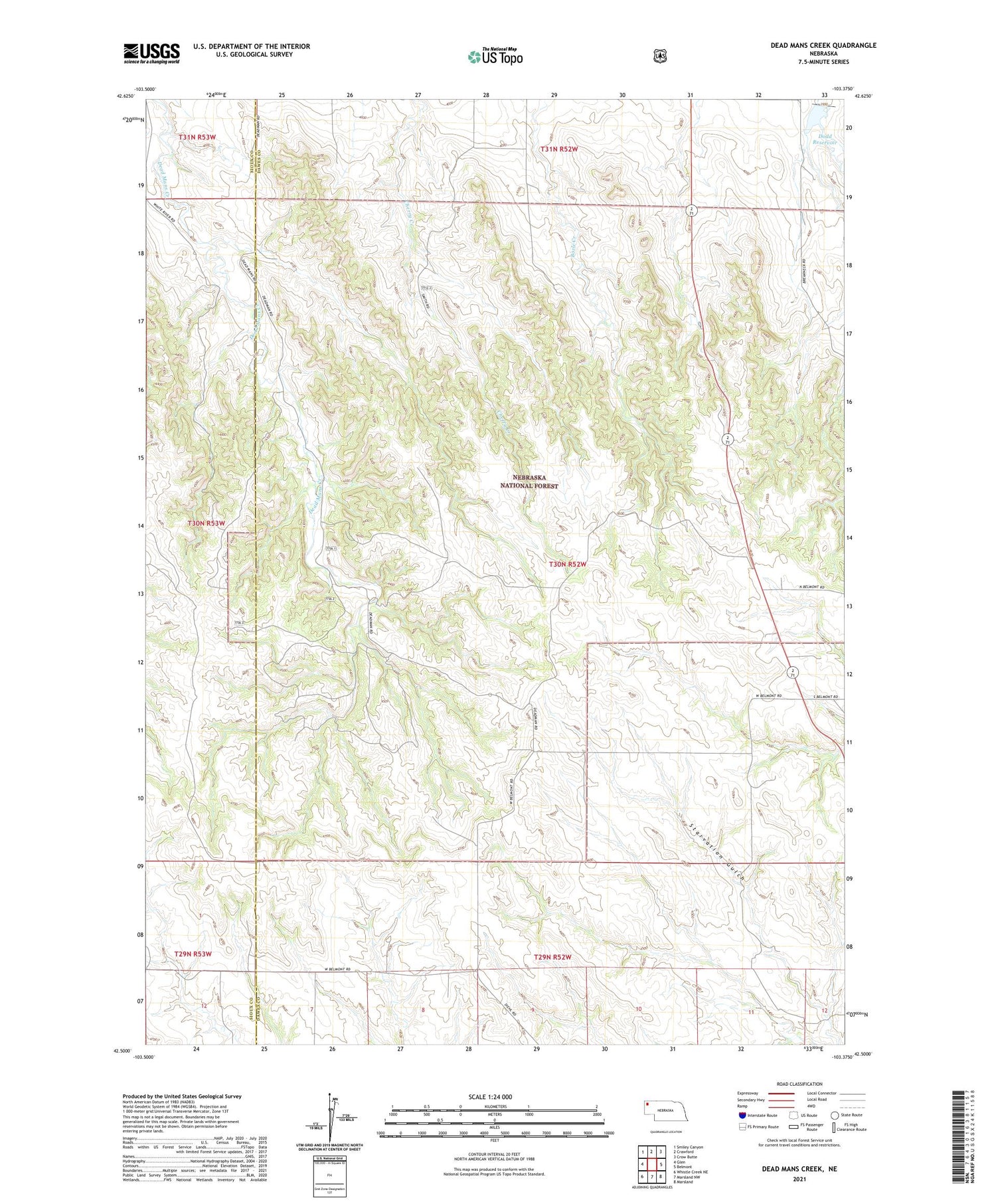
2021 topographic map quadrangle Dead Mans Creek in the state of Nebraska. Scale: 1:24000. Based on the newly updated USGS 7.5' US Topo map series, this map is in the following counties: Dawes, Sioux. The map contains contour data, water features, and other items you are used to seeing on USGS maps, but also has updated roads and other features. This is the next generation of topographic maps. Printed on high-quality waterproof paper with UV fade-resistant inks.
Quads adjacent to this one:
West: Glen
Northwest: Smiley Canyon
North: Crawford
Northeast: Crow Butte
East: Belmont
Southeast: Marsland
South: Marsland NW
Southwest: Whistle Creek NE
Contains the following named places: Cochran State Wayside Area, District School Number 60, Dodd Dam, Dodd Reservoir, ZIP Code: 69339