MyTopo
Glen Nebraska US Topo Map
Couldn't load pickup availability
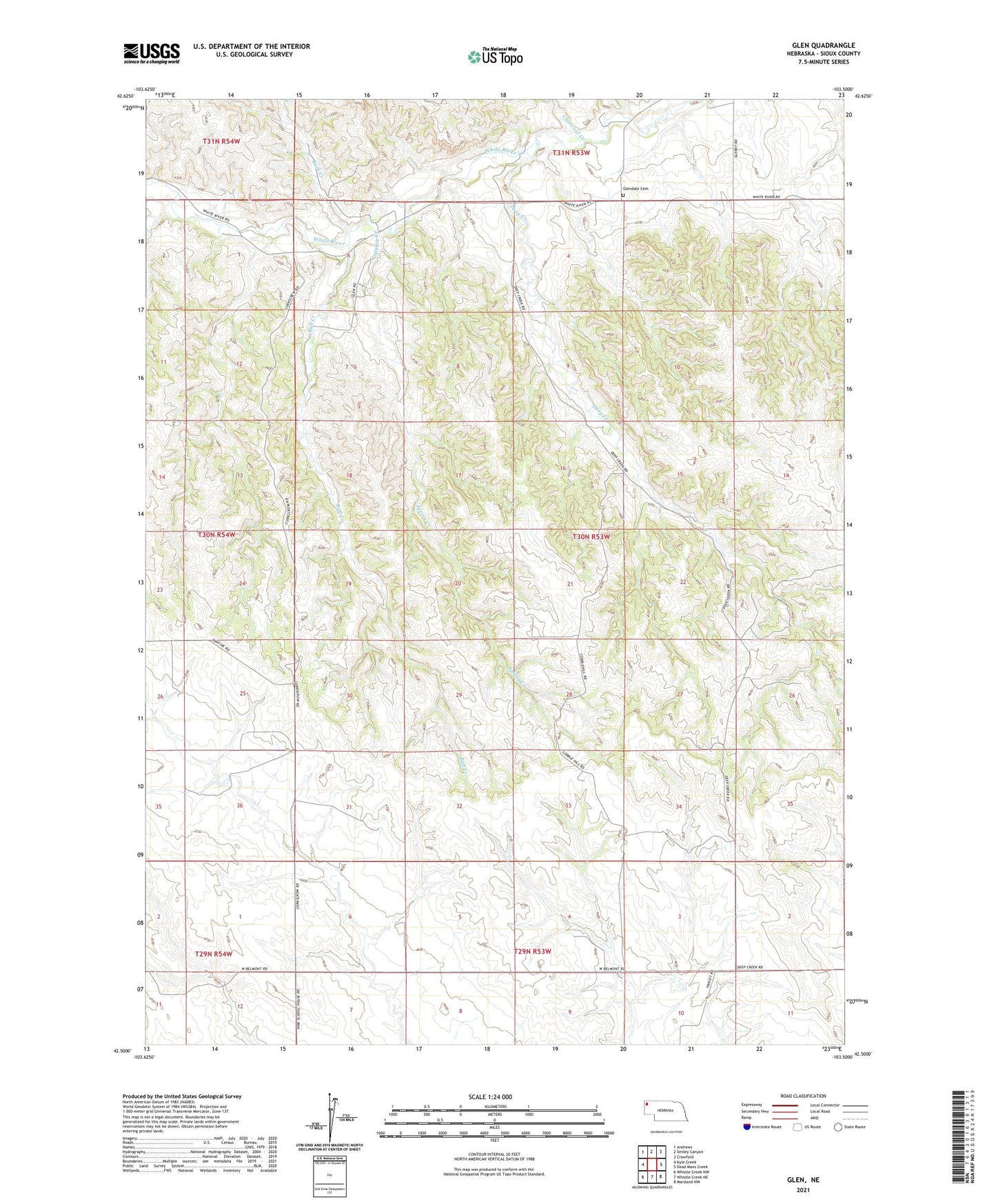
2021 topographic map quadrangle Glen in the state of Nebraska. Scale: 1:24000. Based on the newly updated USGS 7.5' US Topo map series, this map is in the following counties: Sioux. The map contains contour data, water features, and other items you are used to seeing on USGS maps, but also has updated roads and other features. This is the next generation of topographic maps. Printed on high-quality waterproof paper with UV fade-resistant inks.
Quads adjacent to this one:
West: Kyle Creek
Northwest: Andrews
North: Smiley Canyon
Northeast: Crawford
East: Dead Mans Creek
Southeast: Marsland NW
South: Whistle Creek NE
Southwest: Whistle Creek NW
This map covers the same area as the classic USGS quad with code o42103e5.
Contains the following named places: Buck Creek, Bull Creek, Charcoal Creek, Deep Creek, District Elementary School 33, Glen, Glen Post Office, Glen Public School, Glendale Cemetery, Hillview Elementary School, Spring Creek