MyTopo
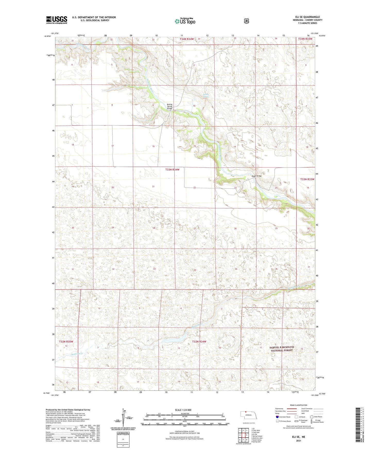
Eli SE Nebraska US Topo Map
Couldn't load pickup availability
Also explore the Eli SE Forest Service Topo of this same quad for updated USFS data
2021 topographic map quadrangle Eli SE in the state of Nebraska. Scale: 1:24000. Based on the newly updated USGS 7.5' US Topo map series, this map is in the following counties: Cherry. The map contains contour data, water features, and other items you are used to seeing on USGS maps, but also has updated roads and other features. This is the next generation of topographic maps. Printed on high-quality waterproof paper with UV fade-resistant inks.
Quads adjacent to this one:
West: Eli SW
Northwest: Eli
North: Cody West
Northeast: Cody East
East: Spring Canyon
Southeast: Spring Lake
South: Heath Valley
Southwest: Medicine Lake
This map covers the same area as the classic USGS quad with code o42101g3.
Contains the following named places: Boiling Spring, Boiling Spring Bridge, Boiling Spring School, E Wobig Ranch, Heath Ranch, Hog Farm, Holler Ranch, J Schneider Ranch, L Schneider Ranch, Mogle Bridge, Mogle Ranch, R Wobig Ranch, Robertson Ranch, Slocum Ranch, ZIP Code: 69211