MyTopo
Eustis SW Nebraska US Topo Map
Couldn't load pickup availability
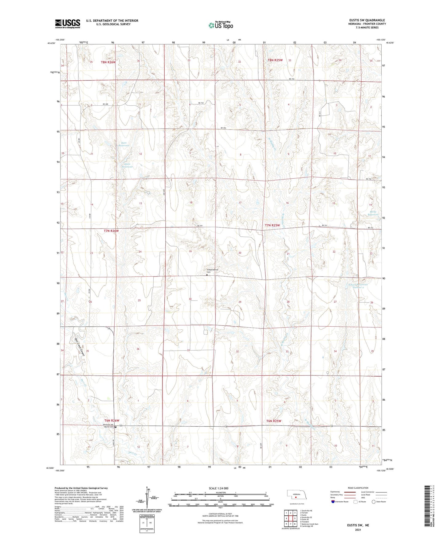
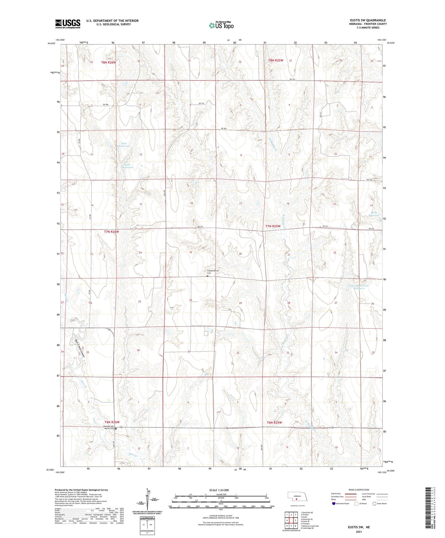
2021 topographic map quadrangle Eustis SW in the state of Nebraska. Scale: 1:24000. Based on the newly updated USGS 7.5' US Topo map series, this map is in the following counties: Frontier. The map contains contour data, water features, and other items you are used to seeing on USGS maps, but also has updated roads and other features. This is the next generation of topographic maps. Printed on high-quality waterproof paper with UV fade-resistant inks.
Quads adjacent to this one:
West: Stockville SE
Northwest: Stockville NE
North: Farnam
Northeast: Eustis
East: Eustis SE
Southeast: Cambridge NE
South: Medicine Creek Dam
Southwest: Freedom
Contains the following named places: Berke Dam, Berke Reservoir, Earl School, Hess Dam, Hess Reservoir, Independence Cemetery, Klein Dam, Klein Reservoir, Logan Election Precinct, Pleasant Hill - Marlin Cemetery, Schurr Dam Number 2, Schurr Reservoir Number 2, Township of Logan