MyTopo
Gladstone Nebraska US Topo Map
Couldn't load pickup availability
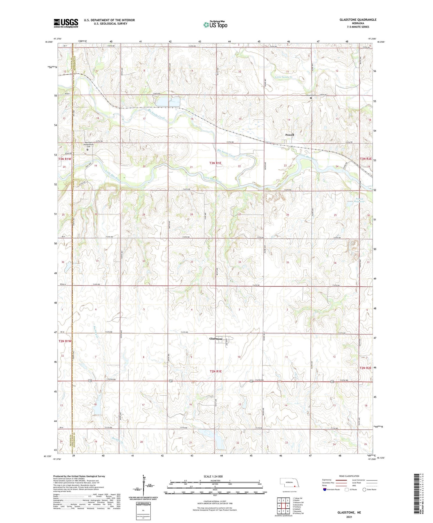
2021 topographic map quadrangle Gladstone in the state of Nebraska. Scale: 1:24000. Based on the newly updated USGS 7.5' US Topo map series, this map is in the following counties: Jefferson, Thayer. The map contains contour data, water features, and other items you are used to seeing on USGS maps, but also has updated roads and other features. This is the next generation of topographic maps. Printed on high-quality waterproof paper with UV fade-resistant inks.
Quads adjacent to this one:
West: Alexandria
Northwest: Tobias SW
North: Daykin
Northeast: Western SW
East: Fairbury
Southeast: Fairbury SW
South: Reynolds
Southwest: Hubbell
Contains the following named places: Alexandria Dam, Alexandria Lakes State Recreation Area, Alexandria Lakes State Wildlife Management Area, Alexandria Reservoir, Big Sandy Creek, Buckley Creek Reservoir 3-C, Buckley Creek Reservoir 4-A, C E Rice Storage Dam, Detention Dam 3-C, Floodwater Retarding Dam 4-A, Gladstone, Gladstone Post Office, Graysons, Jefferson County Recreation Grounds Dam, KUTT-FM (Fairbury), Lincoln Election Precinct, Meridian, Meridian Election Precinct, Meridian Post Office, Meridian Presbyterian Cemetery, Pleasant Hill School, Powell, Powell Cemetery, Powell Post Office, Powell Reservoir, School Number 10, Township of Lincoln, Township of Meridian, Trinity Church, Zion Church