MyTopo
Harrison West Nebraska US Topo Map
Couldn't load pickup availability
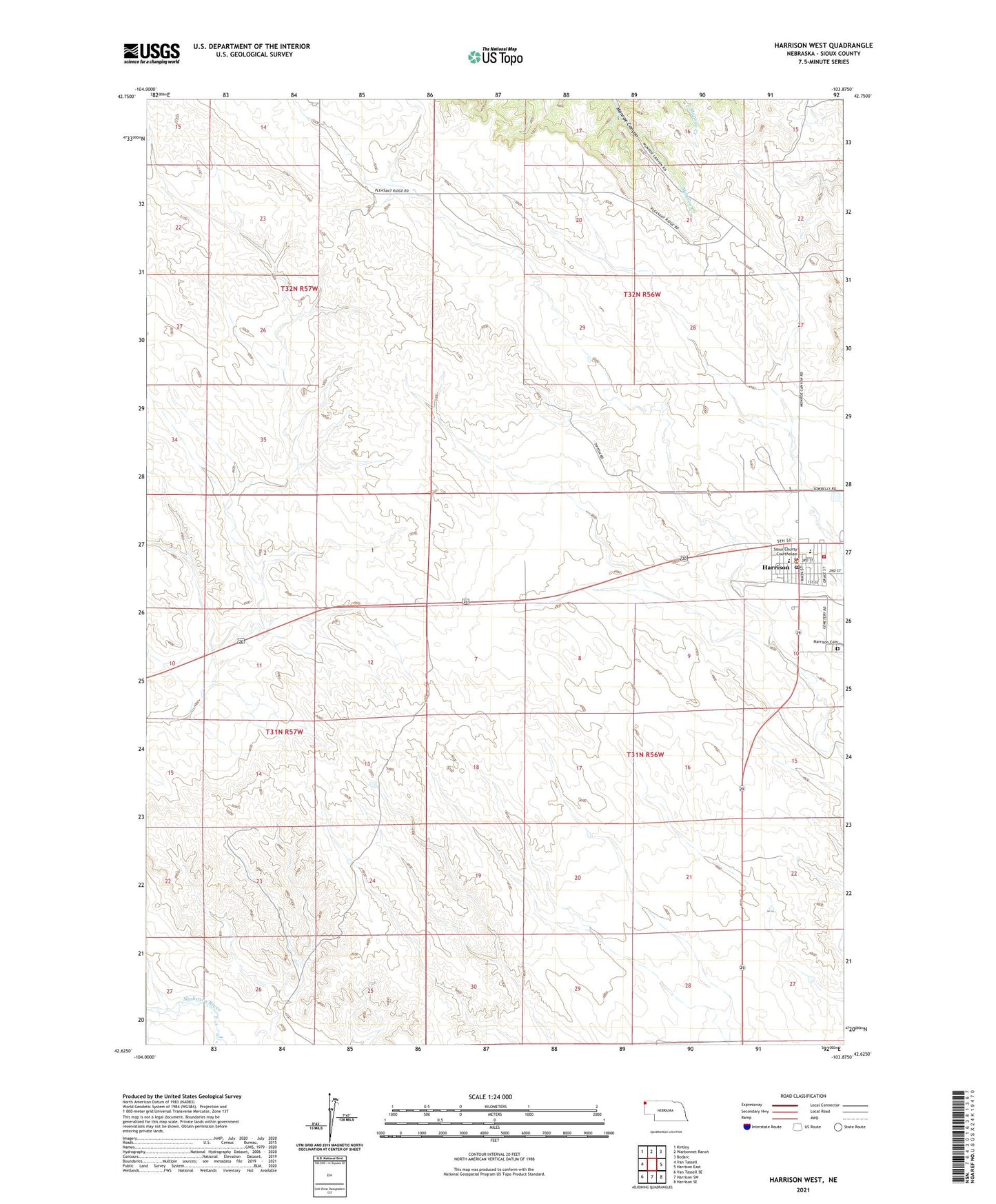
2021 topographic map quadrangle Harrison West in the state of Nebraska. Scale: 1:24000. Based on the newly updated USGS 7.5' US Topo map series, this map is in the following counties: Sioux. The map contains contour data, water features, and other items you are used to seeing on USGS maps, but also has updated roads and other features. This is the next generation of topographic maps. Printed on high-quality waterproof paper with UV fade-resistant inks.
Quads adjacent to this one:
West: Van Tassell
Northwest: Kirtley
North: Warbonnet Ranch
Northeast: Bodarc
East: Harrison East
Southeast: Harrison SE
South: Harrison SW
Southwest: Van Tassell SE
This map covers the same area as the classic USGS quad with code o42103f8.
Contains the following named places: Church of the Nativity of the Blessed Virgin Mary, Gilbert Baker Special Use Area, Harrison, Harrison Bible Church, Harrison Cemetery, Harrison City Park, Harrison Police Department, Harrison Post Office, Harrison Public School, Harrison Skyranch, Harrison Volunteer Fire Department, Memorial United Methodist Church, Parsons Dam, Parsons Reservoir, Sioux County Court House, Sioux County Fairground, Sioux County High School, Sioux County Museum, Sioux County Rescue Unit, Sioux County Sheriff's Office, Village of Harrison, Village of Harrison Historical Marker