MyTopo
Kirtley Wyoming US Topo Map
Couldn't load pickup availability
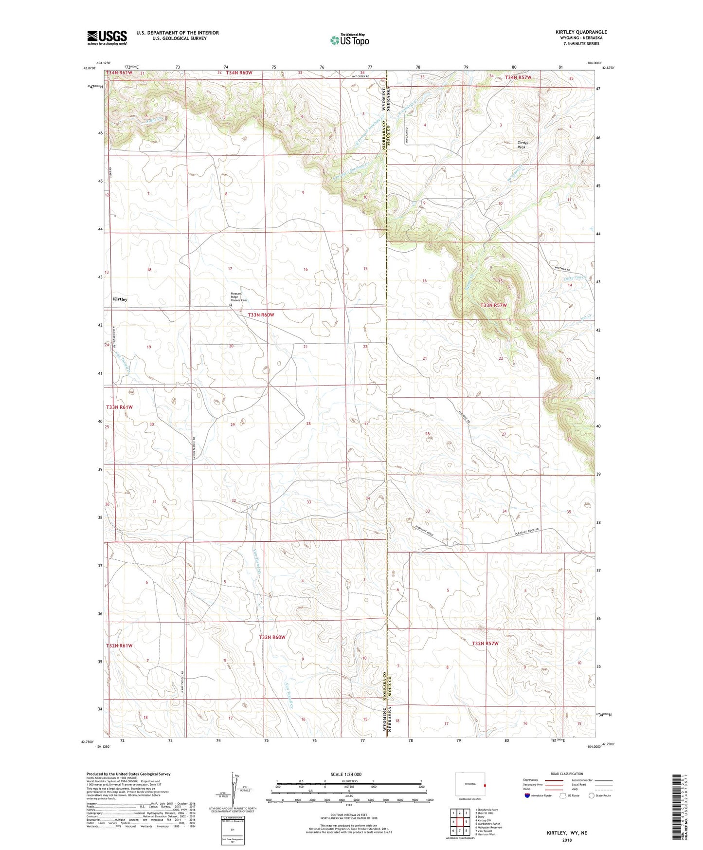
2023 topographic map quadrangle Kirtley in the states of Wyoming, Nebraska. Scale: 1:24000. Based on the newly updated USGS 7.5' US Topo map series, this map is in the following counties: Niobrara, Sioux. The map contains contour data, water features, and other items you are used to seeing on USGS maps, but also has updated roads and other features. This is the next generation of topographic maps. Printed on high-quality waterproof paper with UV fade-resistant inks.
Quads adjacent to this one:
West: Kirtley SW
Northwest: Shepherds Point
North: Sherrill Hills
Northeast: Story
East: Warbonnet Ranch
Southeast: Harrison West
South: Van Tassell
Southwest: McMaster Reservoir
This map covers the same area as the classic USGS quad with code o42104g1.
Contains the following named places: Kirtley, North Prong South Antelope Creek, Pleasant Ridge Pioneer Cemetery, South Prong South Antelope Creek, Turner Peak