MyTopo
Hebron SW Nebraska US Topo Map
Couldn't load pickup availability
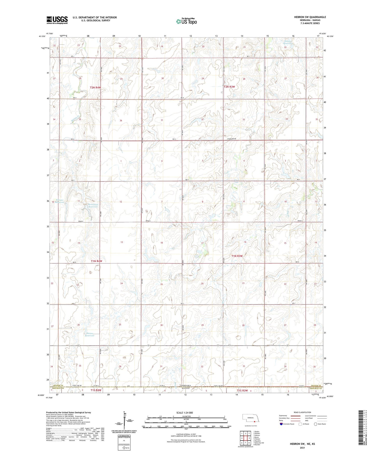
2021 topographic map quadrangle Hebron SW in the state of Nebraska. Scale: 1:24000. Based on the newly updated USGS 7.5' US Topo map series, this map is in the following counties: Thayer, Republic. The map contains contour data, water features, and other items you are used to seeing on USGS maps, but also has updated roads and other features. This is the next generation of topographic maps. Printed on high-quality waterproof paper with UV fade-resistant inks.
Quads adjacent to this one:
West: Byron
Northwest: Ruskin
North: Deshler
Northeast: Hebron
East: Chester
Southeast: Munden
South: Belleville NW
Southwest: Republic
Contains the following named places: Bostelman Dam, Bostelman Reservoir, Byron Election Precinct, Cracker Box School, Dittmer Dam, Dittmer Reservoir, Harms Dam, Harms Reservoir, Koester Dam, Koester Reservoir, Prairie Rose School, Saint James Church, Spring Creek School, Stoddard School, Township of Stoddard, Walnut Corner School