MyTopo
Hooper Nebraska US Topo Map
Couldn't load pickup availability
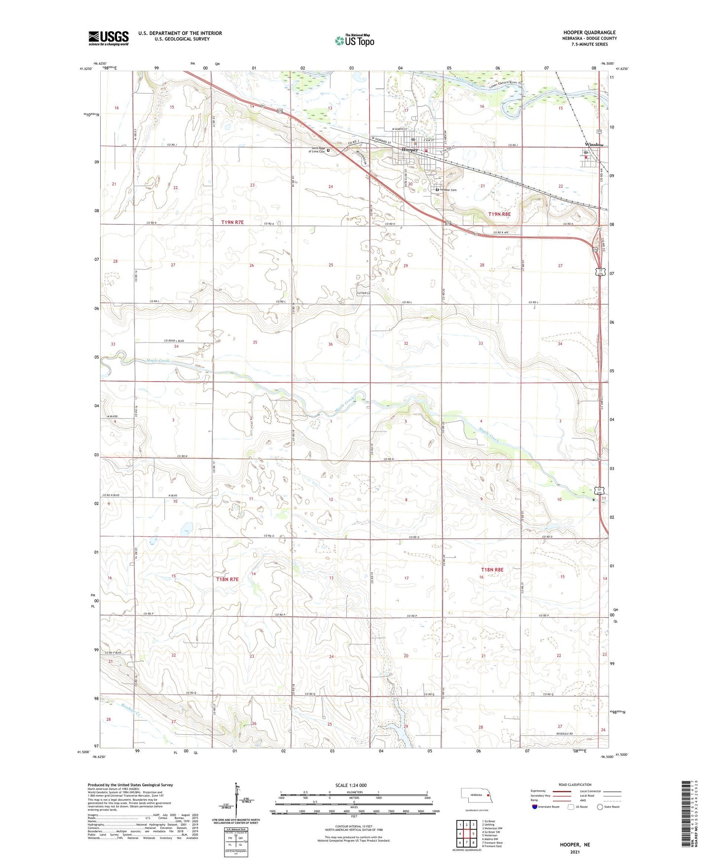
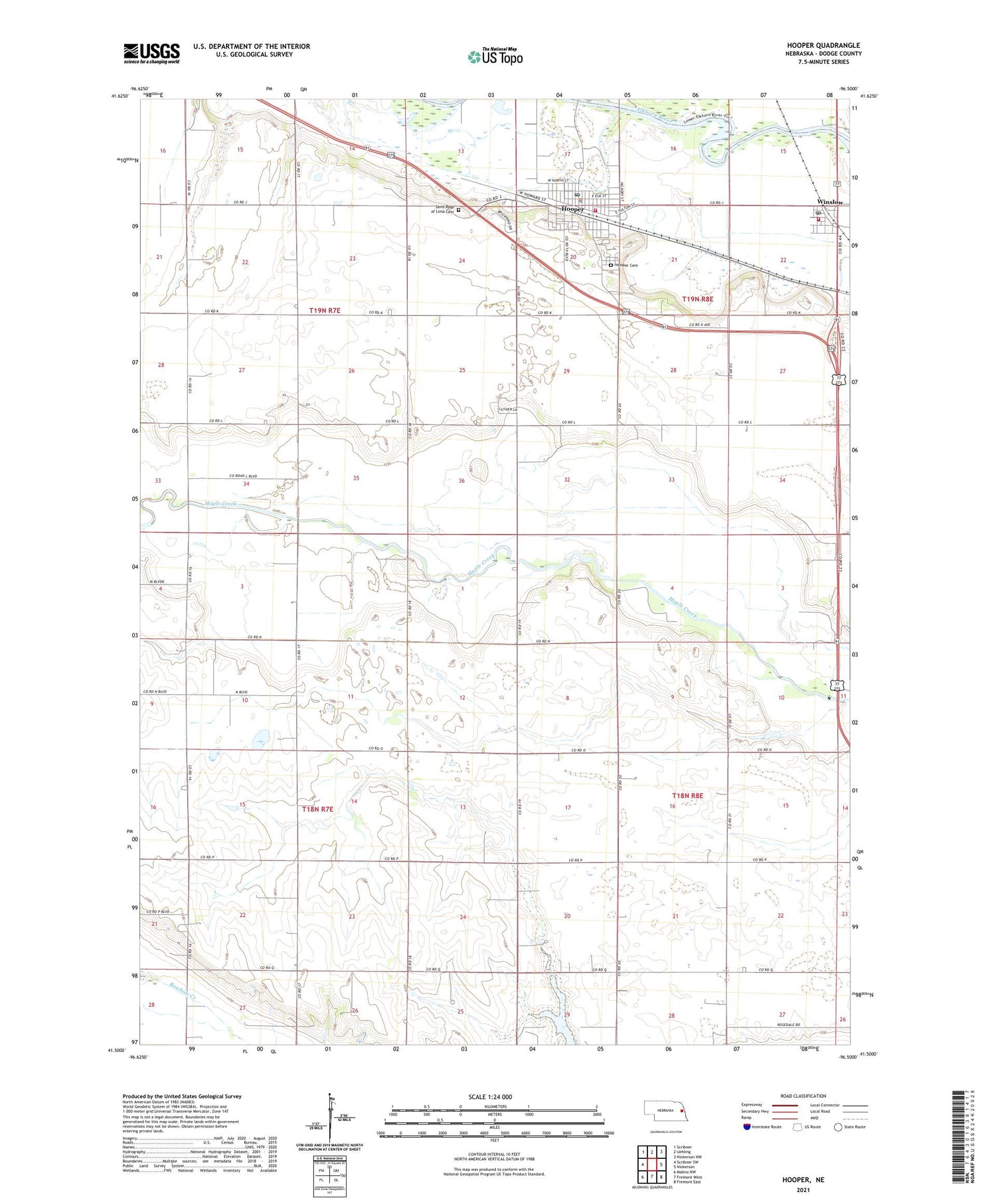
2021 topographic map quadrangle Hooper in the state of Nebraska. Scale: 1:24000. Based on the newly updated USGS 7.5' US Topo map series, this map is in the following counties: Dodge. The map contains contour data, water features, and other items you are used to seeing on USGS maps, but also has updated roads and other features. This is the next generation of topographic maps. Printed on high-quality waterproof paper with UV fade-resistant inks.
Quads adjacent to this one:
West: Scribner SW
Northwest: Scribner
North: Uehling
Northeast: Nickerson NW
East: Nickerson
Southeast: Fremont East
South: Fremont West
Southwest: Malmo NW
Contains the following named places: Bellevue School, Bethel Church, Bluffs Church, City of Hooper, Elkhorn Valley Golf Course, Faith United Methodist Church, Hooper, Hooper Care Center, Hooper Cemetery, Hooper Dam, Hooper Elementary School, Hooper Fire and Rescue, Hooper Medical Clinic, Hooper Memorial Park, Hooper Memorial Park Campground, Hooper Police Department, Hooper Post Office, Hooper Public Library, Hooper Reservoir, Jalapa Post Office, Kerstein Reservoir, Luther-Broadview Public School, Redeemer Evangelical Lutheran Church, Saint John Lutheran Church, Saint Rose of Lima Cemetery, Saint Rose of Lima Church, School Number 48, School Number 88, Scribner Air Base Dam, Scribner State Airport, Township of Everett, Township of Hooper, Township of Maple, Village of Winslow, Winslow, Winslow City Park, Winslow City Park Campground, Winslow Fire and Rescue, Winslow Post Office, ZIP Code: 68072