MyTopo
Uehling Nebraska US Topo Map
Couldn't load pickup availability
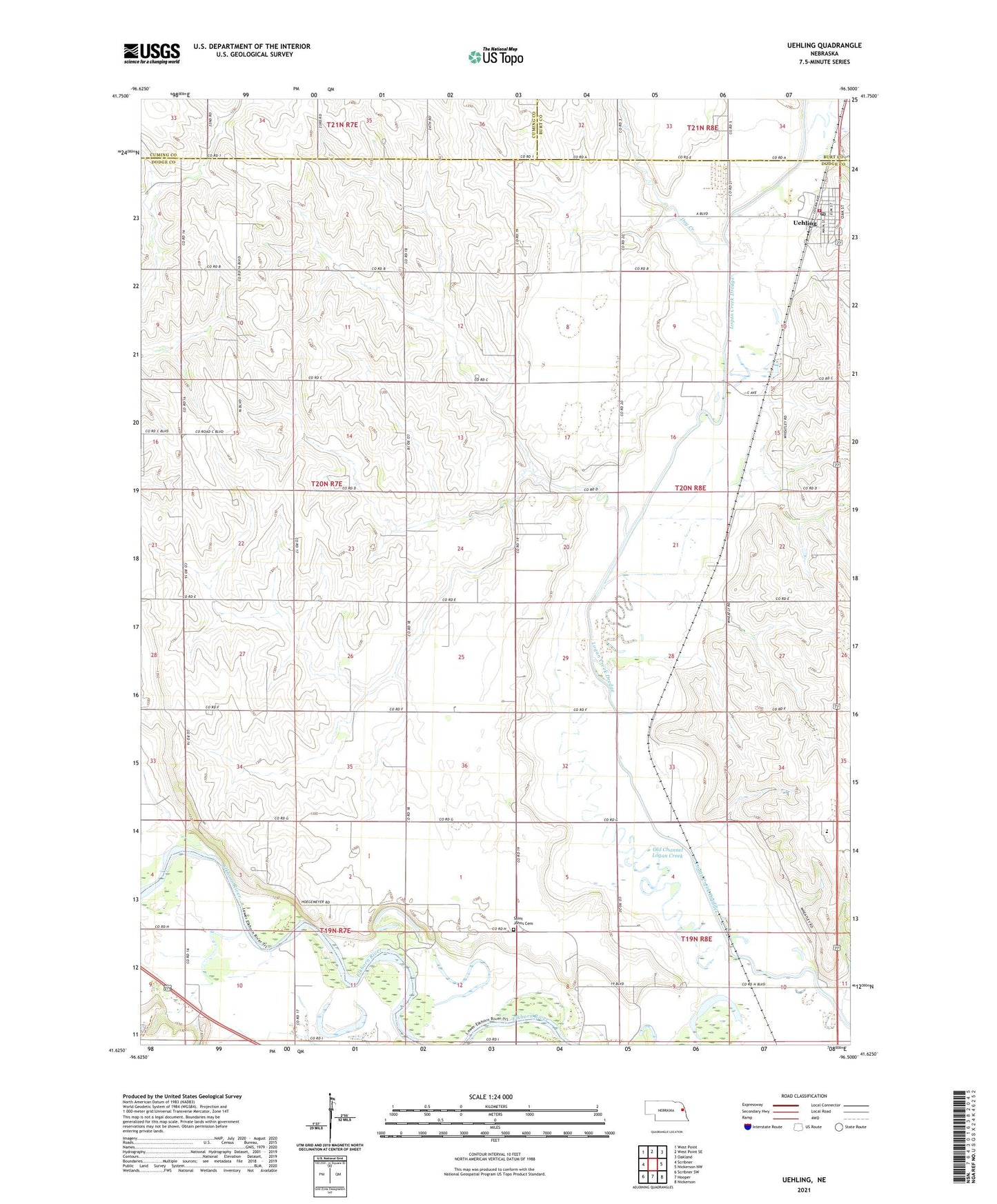
2021 topographic map quadrangle Uehling in the state of Nebraska. Scale: 1:24000. Based on the newly updated USGS 7.5' US Topo map series, this map is in the following counties: Dodge, Cuming, Burt. The map contains contour data, water features, and other items you are used to seeing on USGS maps, but also has updated roads and other features. This is the next generation of topographic maps. Printed on high-quality waterproof paper with UV fade-resistant inks.
Quads adjacent to this one:
West: Scribner
Northwest: West Point
North: West Point SE
Northeast: Oakland
East: Nickerson NW
Southeast: Nickerson
South: Hooper
Southwest: Scribner SW
This map covers the same area as the classic USGS quad with code o41096f5.
Contains the following named places: Agland Cooperative Elevator, Dry Creek, First Congregational Church, KWPN-FM (West Point), Lewisburgh Post Office, Logan View Junior-Senior High School, Old Channel Logan Creek, Saint Johns Cemetery, Saint Johns Church, Saint Paul Church, Saint Pauls Lutheran Church, School Number 16, School Number 18, School Number 35, School Number 60, School Number 83, School Number 89, Township of Cuming, Township of Logan, Uehling, Uehling Elementary School, Uehling Fire Department, Uehling Post Office, Uehling Rescue Squad, Village of Uehling, ZIP Code: 68031