MyTopo
Scribner SW Nebraska US Topo Map
Couldn't load pickup availability
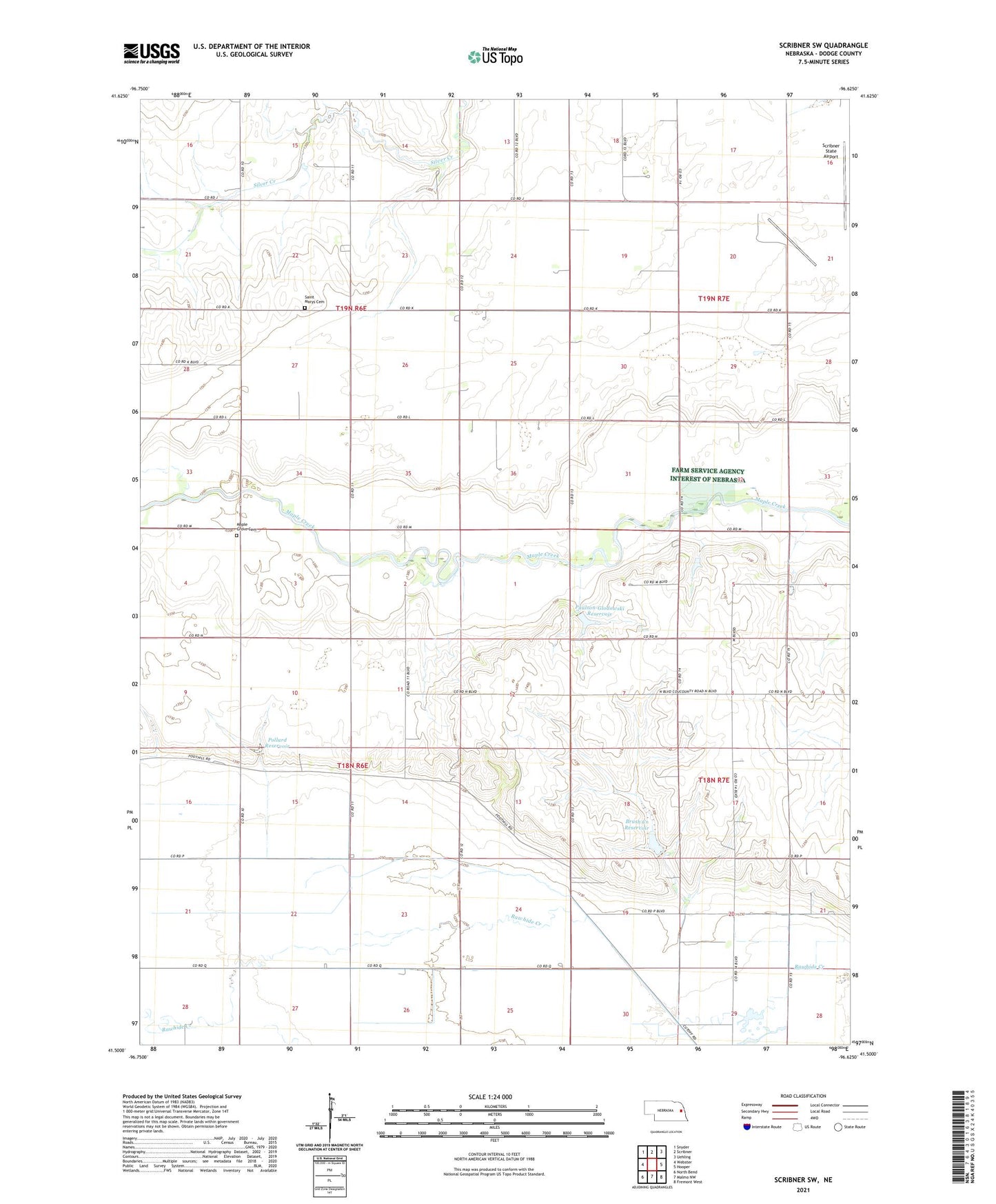
2021 topographic map quadrangle Scribner SW in the state of Nebraska. Scale: 1:24000. Based on the newly updated USGS 7.5' US Topo map series, this map is in the following counties: Dodge. The map contains contour data, water features, and other items you are used to seeing on USGS maps, but also has updated roads and other features. This is the next generation of topographic maps. Printed on high-quality waterproof paper with UV fade-resistant inks.
Quads adjacent to this one:
West: Webster
Northwest: Snyder
North: Scribner
Northeast: Uehling
East: Hooper
Southeast: Fremont West
South: Malmo NW
Southwest: North Bend
This map covers the same area as the classic USGS quad with code o41096e6.
Contains the following named places: Brush Creek Dam, Brush Creek Reservoir, Cotterell Public School, Dodge County, Maple Grove Cemetery, Paulson-Glodowski Dam, Paulson-Glodowski Reservoir, Pollard Dam, Pollard Reservoir, Saint Johns Church, Saint Marys Cemetery, School Number 12, School Number 22, School Number 90, Scribner Army Air Field, Timberville Post Office, Township of Cotterell, Township of Ridgeley