MyTopo
Keystone Nebraska US Topo Map
Couldn't load pickup availability
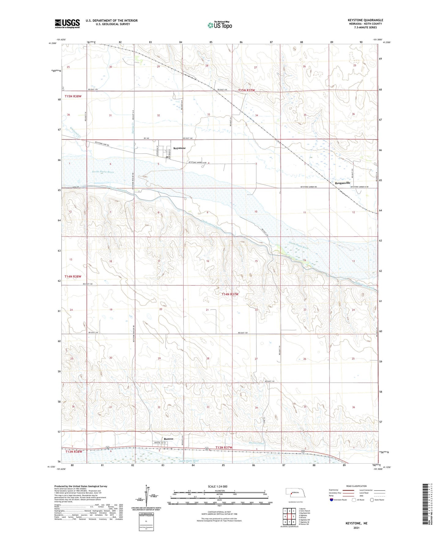
2021 topographic map quadrangle Keystone in the state of Nebraska. Scale: 1:24000. Based on the newly updated USGS 7.5' US Topo map series, this map is in the following counties: Keith. The map contains contour data, water features, and other items you are used to seeing on USGS maps, but also has updated roads and other features. This is the next generation of topographic maps. Printed on high-quality waterproof paper with UV fade-resistant inks.
Quads adjacent to this one:
West: Ogallala
Northwest: Martin
North: Glinn Ranch
Northeast: Big Bald Hill
East: Nevens
Southeast: Paxton SW
South: Ogallala SE
Southwest: Ogallala SW
This map covers the same area as the classic USGS quad with code o41101b5.
Contains the following named places: Brogan Ranch, Broganville, Farmer Co-operative Association Elevator, Keystone, Keystone Census Designated Place, Keystone Post Office, Keystone Public School, Keystone Station, Little Church at Keystone, Meismer Ranch, Roscoe, Roscoe Census Designated Place, Roscoe Post Office, School Number 34, Spring Creek, United Methodist Church, United Presbyterian Church, Whitetail Creek