MyTopo
Ogallala SE Nebraska US Topo Map
Couldn't load pickup availability
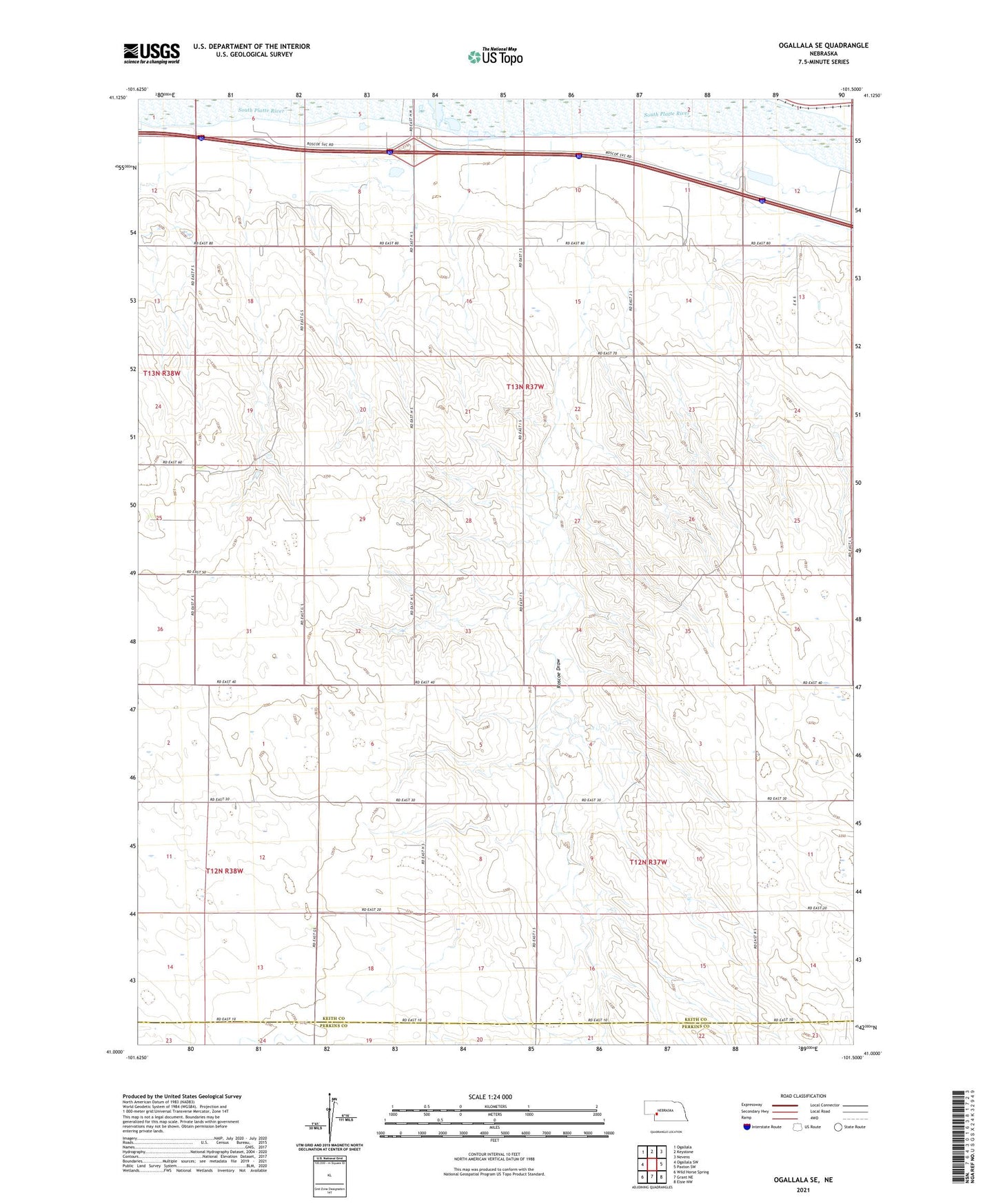
2021 topographic map quadrangle Ogallala SE in the state of Nebraska. Scale: 1:24000. Based on the newly updated USGS 7.5' US Topo map series, this map is in the following counties: Keith, Perkins. The map contains contour data, water features, and other items you are used to seeing on USGS maps, but also has updated roads and other features. This is the next generation of topographic maps. Printed on high-quality waterproof paper with UV fade-resistant inks.
Quads adjacent to this one:
West: Ogallala SW
Northwest: Ogallala
North: Keystone
Northeast: Nevens
East: Paxton SW
Southeast: Elsie NW
South: Grant NE
Southwest: Wild Horse Spring
This map covers the same area as the classic USGS quad with code o41101a5.
Contains the following named places: Ash Hollow Historical Marker, Court House Chimney Rock and Scotts Bluff Historical Marker, Logan Election Precinct, Ogallala Historical Marker, Ogallala Rest Area - Westbound, Ogallala Westbound Travel Information Center, Roscoe Draw, Saint John Church, School Number 7