MyTopo
Leigh Nebraska US Topo Map
Couldn't load pickup availability
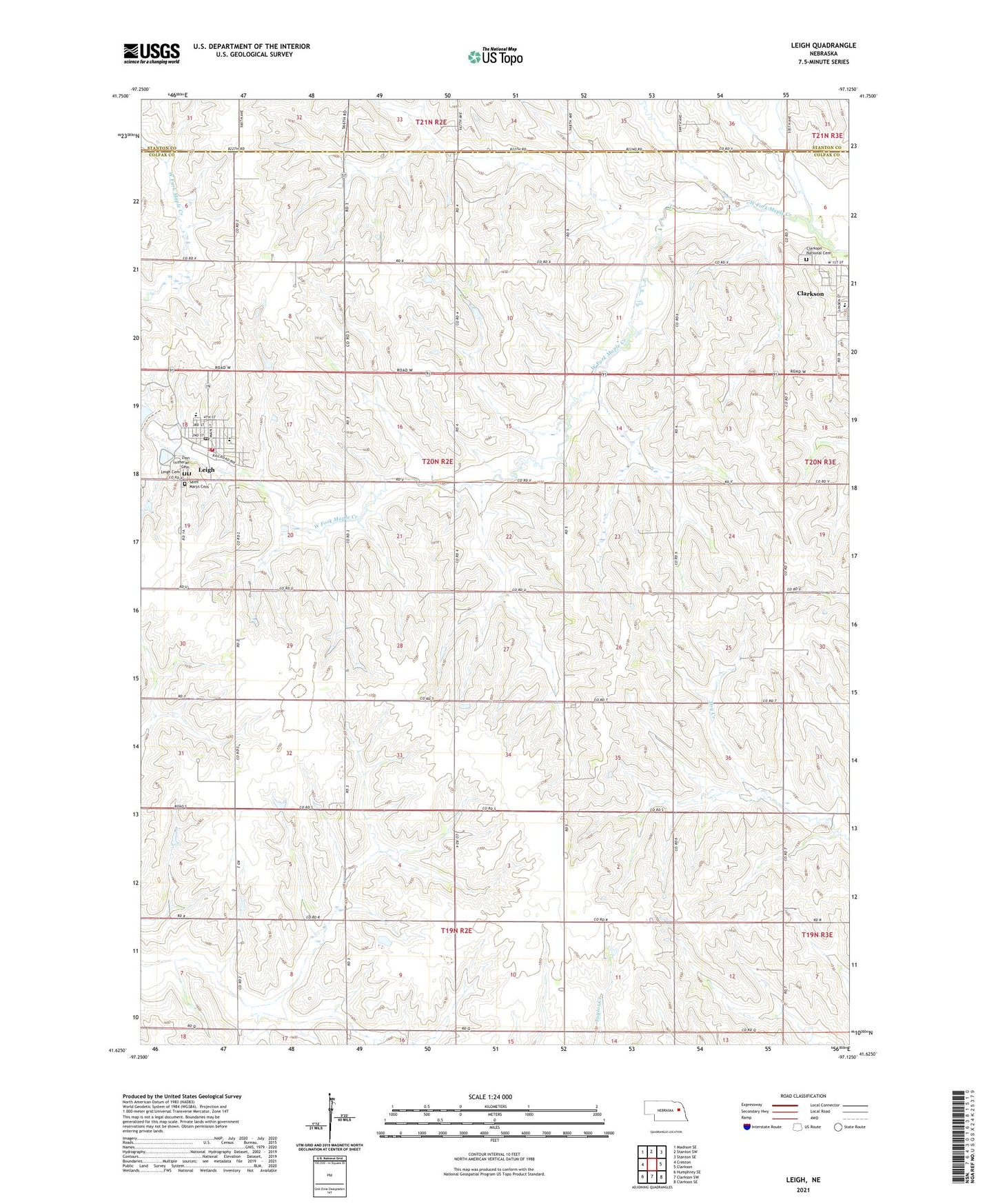
2021 topographic map quadrangle Leigh in the state of Nebraska. Scale: 1:24000. Based on the newly updated USGS 7.5' US Topo map series, this map is in the following counties: Colfax, Stanton. The map contains contour data, water features, and other items you are used to seeing on USGS maps, but also has updated roads and other features. This is the next generation of topographic maps. Printed on high-quality waterproof paper with UV fade-resistant inks.
Quads adjacent to this one:
West: Creston
Northwest: Madison SE
North: Stanton SW
Northeast: Stanton SE
East: Clarkson
Southeast: Clarkson SE
South: Clarkson SW
Southwest: Humphrey SE
Contains the following named places: Centennial Park, Centennial Park Campground, Clarkson National Cemetery, Colfax County Fairgrounds, Fairview School, Folken Feed Yards, Hillcrest School, House of Yesteryear, Leigh, Leigh Cemetery, Leigh Elementary School, Leigh High School, Leigh Police Department, Leigh Post Office, Leigh Public Library, Leigh Rescue Unit, Leigh Volunteer Fire Department and Rescue, Maple Valley Cooperative Elevator, New Zion Presbyterian Church, Plain View School, Rick Charipar Memorial Golf Course, Saint John Neumann Elementary School, Saint Marys Cemetery, Saint Marys Church, Saints Cyril and Methodious Catholic Church, School Number 30, School Number 42, Stanton Election Precinct, Township of Stanton, Village of Leigh, Zion Lutheran Cemetery, Zion Lutheran School, ZIP Code: 68629