MyTopo
Lewellen Nebraska US Topo Map
Couldn't load pickup availability
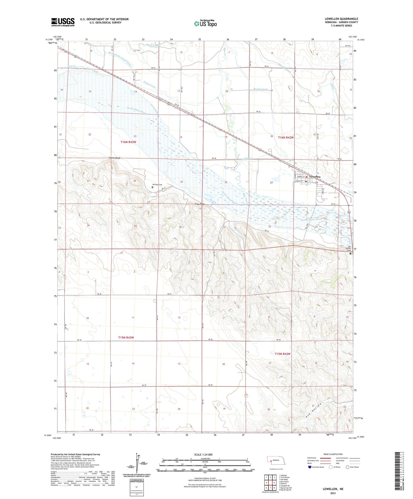
2021 topographic map quadrangle Lewellen in the state of Nebraska. Scale: 1:24000. Based on the newly updated USGS 7.5' US Topo map series, this map is in the following counties: Garden. The map contains contour data, water features, and other items you are used to seeing on USGS maps, but also has updated roads and other features. This is the next generation of topographic maps. Printed on high-quality waterproof paper with UV fade-resistant inks.
Quads adjacent to this one:
West: Barn Butte
Northwest: Oshkosh
North: Twin Buttes
Northeast: Old Baldy
East: Ruthton
Southeast: Big Springs NE
South: Big Springs NW
Southwest: Chappell NE
This map covers the same area as the classic USGS quad with code o41102c2.
Contains the following named places: Ash Hollow Cemetery, Battle of Blue Water Historical Marker, Blue Creek, Blue Creek Canal, Clay Peak, Durham Cemetery, Farmers Elevator, Garden County Fairgrounds, Grace Lutheran Church, Hooper Canal, Js Otter Creek Resort, Lewellen, Lewellen Nursing Home, Lewellen Post Office, Lewellen Public Library, Lewellen Public School, Lewellen Volunteer Fire Department, Lost Creek, Lutherville, Midland Overland Canal, Signal Bluff, Union Canal, United Methodist Church, Village of Lewellen, Wallesen Grain Company Incorporated Elevator, Wesleyan Church Annex