MyTopo
Loma Nebraska US Topo Map
Couldn't load pickup availability
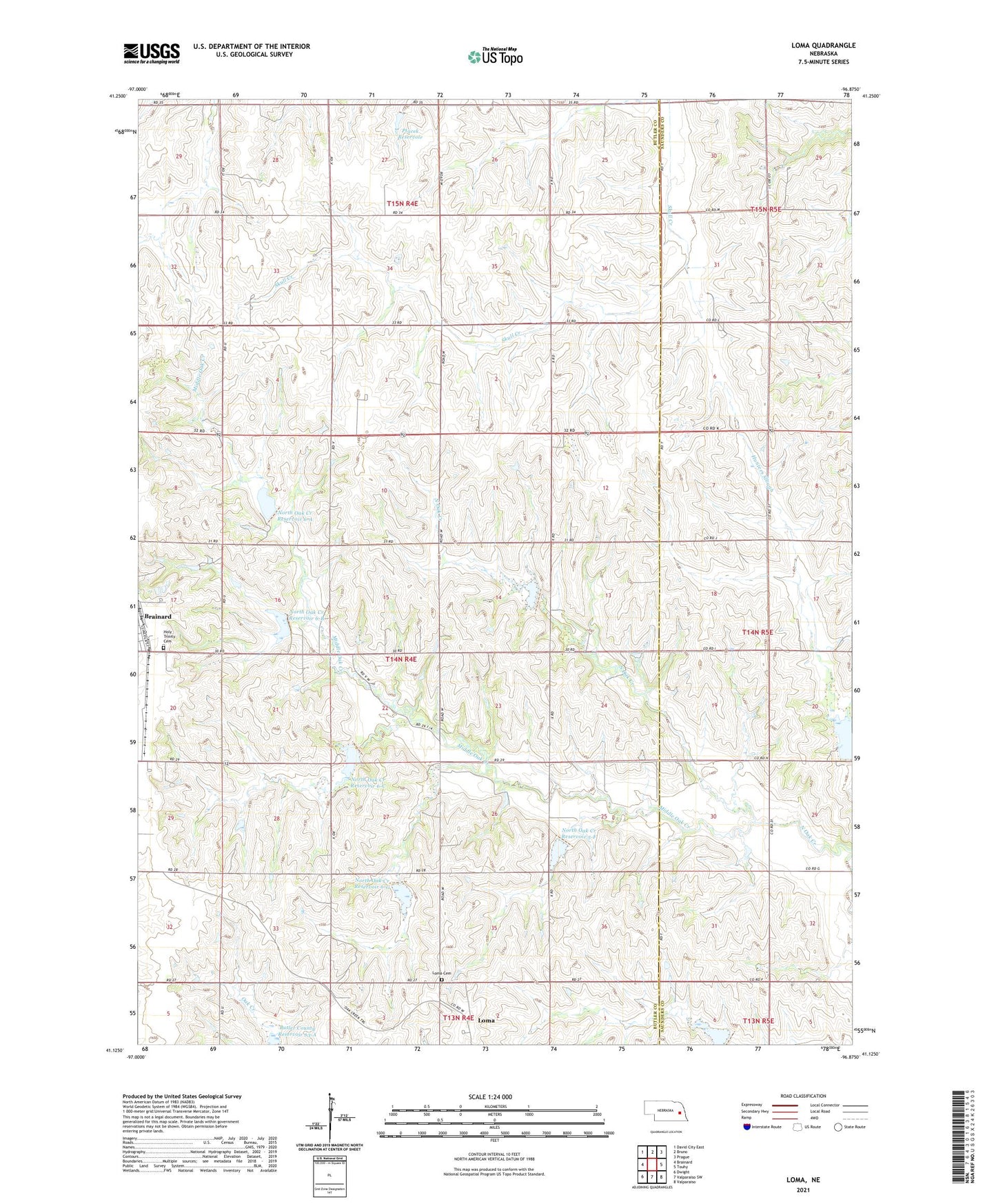
2021 topographic map quadrangle Loma in the state of Nebraska. Scale: 1:24000. Based on the newly updated USGS 7.5' US Topo map series, this map is in the following counties: Butler, Saunders. The map contains contour data, water features, and other items you are used to seeing on USGS maps, but also has updated roads and other features. This is the next generation of topographic maps. Printed on high-quality waterproof paper with UV fade-resistant inks.
Quads adjacent to this one:
West: Brainard
Northwest: David City East
North: Bruno
Northeast: Prague
East: Touhy
Southeast: Valparaiso
South: Valparaiso SW
Southwest: Dwight
Contains the following named places: Brainard, Butler County Reservoir 63-A, Detention Dam 63-A, Holy Trinity Cemetery, La Cross School, Loma, Loma Cemetery, Loma Post Office, Middle Oak Creek, North Oak Creek Dam 5-F, North Oak Creek Dam 6-A, North Oak Creek Dam 6-B, North Oak Creek Dam 6-C, North Oak Creek Dam 6-G, North Oak Creek Reservoir 5-F, North Oak Creek Reservoir 6-A, North Oak Creek Reservoir 6-B, North Oak Creek Reservoir 6-C, North Oak Creek Reservoir 6-G, Ptacek Dam, Ptacek Reservoir, Saint Lukes Catholic Church, Timber Point Lake, Township of Oak Creek, ZIP Code: 68626