MyTopo
Touhy Nebraska US Topo Map
Couldn't load pickup availability
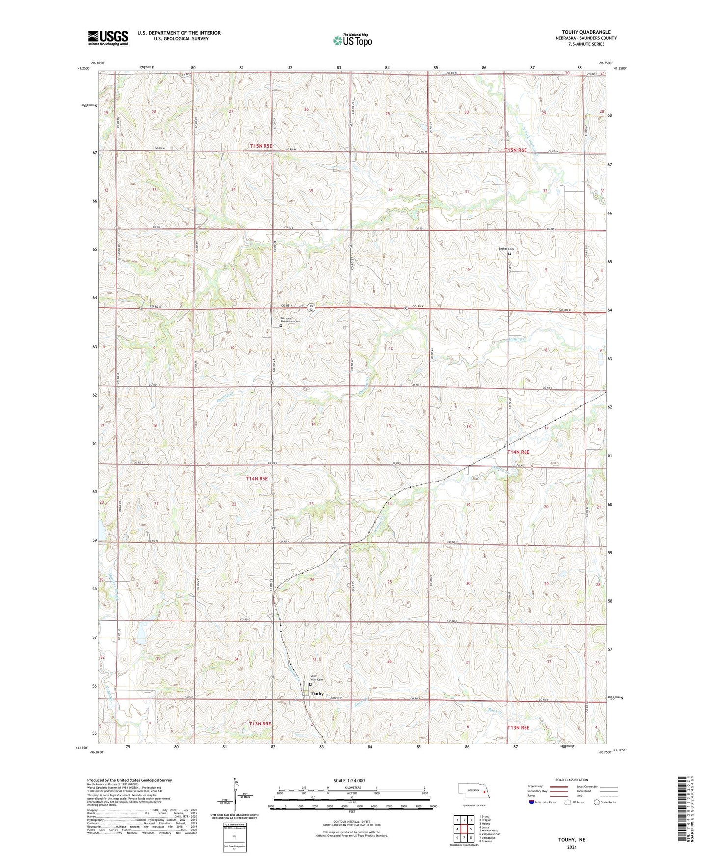
2021 topographic map quadrangle Touhy in the state of Nebraska. Scale: 1:24000. Based on the newly updated USGS 7.5' US Topo map series, this map is in the following counties: Saunders. The map contains contour data, water features, and other items you are used to seeing on USGS maps, but also has updated roads and other features. This is the next generation of topographic maps. Printed on high-quality waterproof paper with UV fade-resistant inks.
Quads adjacent to this one:
West: Loma
Northwest: Bruno
North: Prague
Northeast: Malmo
East: Wahoo West
Southeast: Ceresco
South: Valparaiso
Southwest: Valparaiso SW
This map covers the same area as the classic USGS quad with code o41096b7.
Contains the following named places: Bethel Cemetery, Crowder School, Hunters Slough, National Bohemian Cemetery, North Oak Creek, Saint Vitus Catholic Church, Saint Vitus Cemetery, School Number 24, School Number 74, Sunnyside School, Touhy, Touhy Post Office, Touhy Public School, Township of Newman, ZIP Code: 68070