MyTopo
Bristow Nebraska US Topo Map
Couldn't load pickup availability
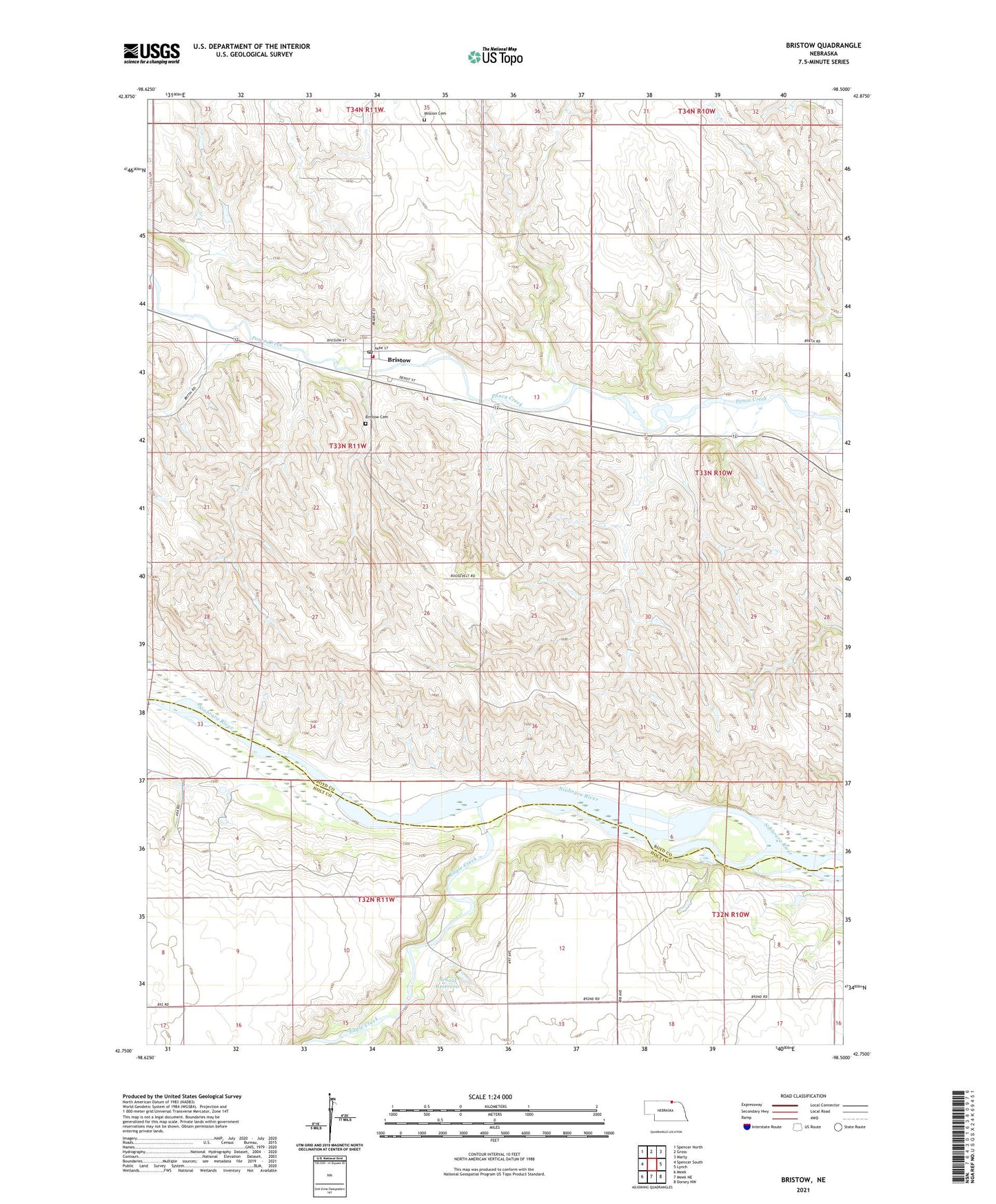
2021 topographic map quadrangle Bristow in the state of Nebraska. Scale: 1:24000. Based on the newly updated USGS 7.5' US Topo map series, this map is in the following counties: Boyd, Holt. The map contains contour data, water features, and other items you are used to seeing on USGS maps, but also has updated roads and other features. This is the next generation of topographic maps. Printed on high-quality waterproof paper with UV fade-resistant inks.
Quads adjacent to this one:
West: Spencer South
Northwest: Spencer North
North: Gross
Northeast: Marty
East: Lynch
Southeast: Dorsey NW
South: Meek NE
Southwest: Meek
This map covers the same area as the classic USGS quad with code o42098g5.
Contains the following named places: Bristow, Bristow Cemetery, Bristow Post Office, Bristow Volunteer Fire Department, Eagle Creek, Mission Cemetery, Paddock, Paddock Post Office, Schaaf Dam, Schaaf Reservoir, School Number 1, School Number 13, School Number 31, School Number 34, School Number 35, School Number 57, School Number 72, Township of Bristow, Trinity Lutheran Church, Village of Bristow