MyTopo
Stanton Nebraska US Topo Map
Couldn't load pickup availability
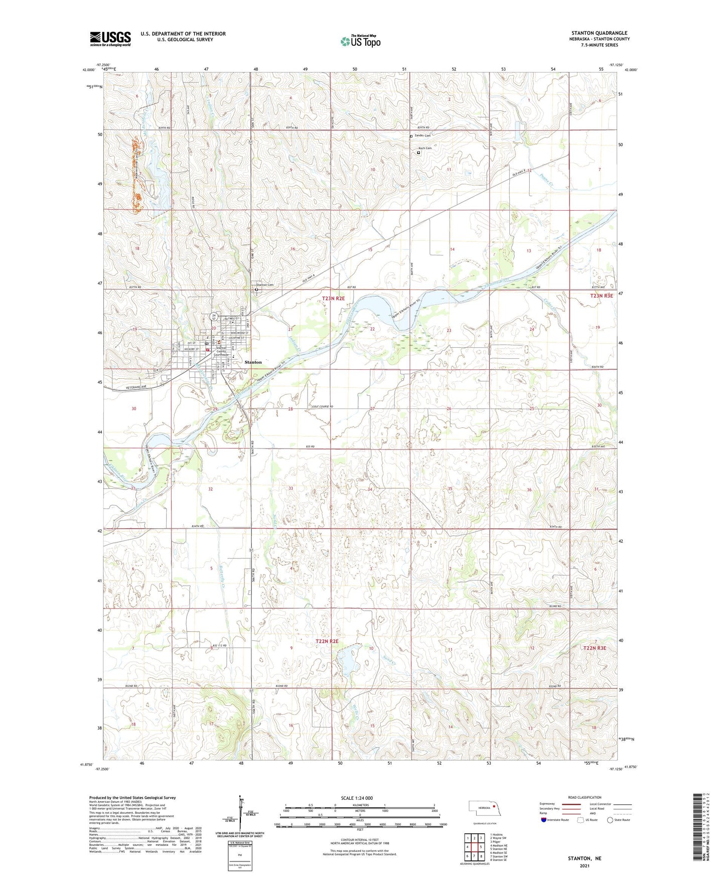
2021 topographic map quadrangle Stanton in the state of Nebraska. Scale: 1:24000. Based on the newly updated USGS 7.5' US Topo map series, this map is in the following counties: Stanton. The map contains contour data, water features, and other items you are used to seeing on USGS maps, but also has updated roads and other features. This is the next generation of topographic maps. Printed on high-quality waterproof paper with UV fade-resistant inks.
Quads adjacent to this one:
West: Madison NE
Northwest: Hoskins
North: Wayne SW
Northeast: Pilger
East: Stanton NE
Southeast: Stanton SE
South: Stanton SW
Southwest: Madison SE
This map covers the same area as the classic USGS quad with code o41097h2.
Contains the following named places: Allied Chiropractic Health Center, Butterfly Creek, Cedar Creek, City of Stanton, Elkhorn Acres Golf Club, Evangelical Free Church, Faith Lutheran Church, Indian Creek, Indian Creek Ranch, Koch Cemetery, Maskenthine Arboretum, Maskenthine Creek, Maskenthine Lake Recreation Area, Maskenthine Multiple-Purpose Dam, Maskenthine Reservoir, New England Congregational Church, Saint Johns Lutheran Church, Saint Johns Lutheran Elementary School, Saint Lukes Lutheran Church, Saint Peters Catholic Church, Sand Creek, Sand Creek Dam 2, Sand Creek Reservoir 2, School Number 15, School Number 2, Stanton, Stanton Cemetery, Stanton County, Stanton County Courthouse, Stanton County Fairgrounds, Stanton County Sheriffs Office, Stanton Dental Clinic, Stanton Election Precinct, Stanton Elementary School, Stanton Feed and Grain Company Elevator, Stanton High School, Stanton Medical Clinic, Stanton Mobile Park, Stanton Nursing Home, Stanton Police Department, Stanton Post Office, Stanton Public Library, Stanton Rescue Service, Stanton Volunteer Fire Department, Township of Stanton, Union Creek, United Methodist Church, Wells Creek, Zander Cemetery, ZIP Code: 68779