MyTopo
Malmo Nebraska US Topo Map
Couldn't load pickup availability
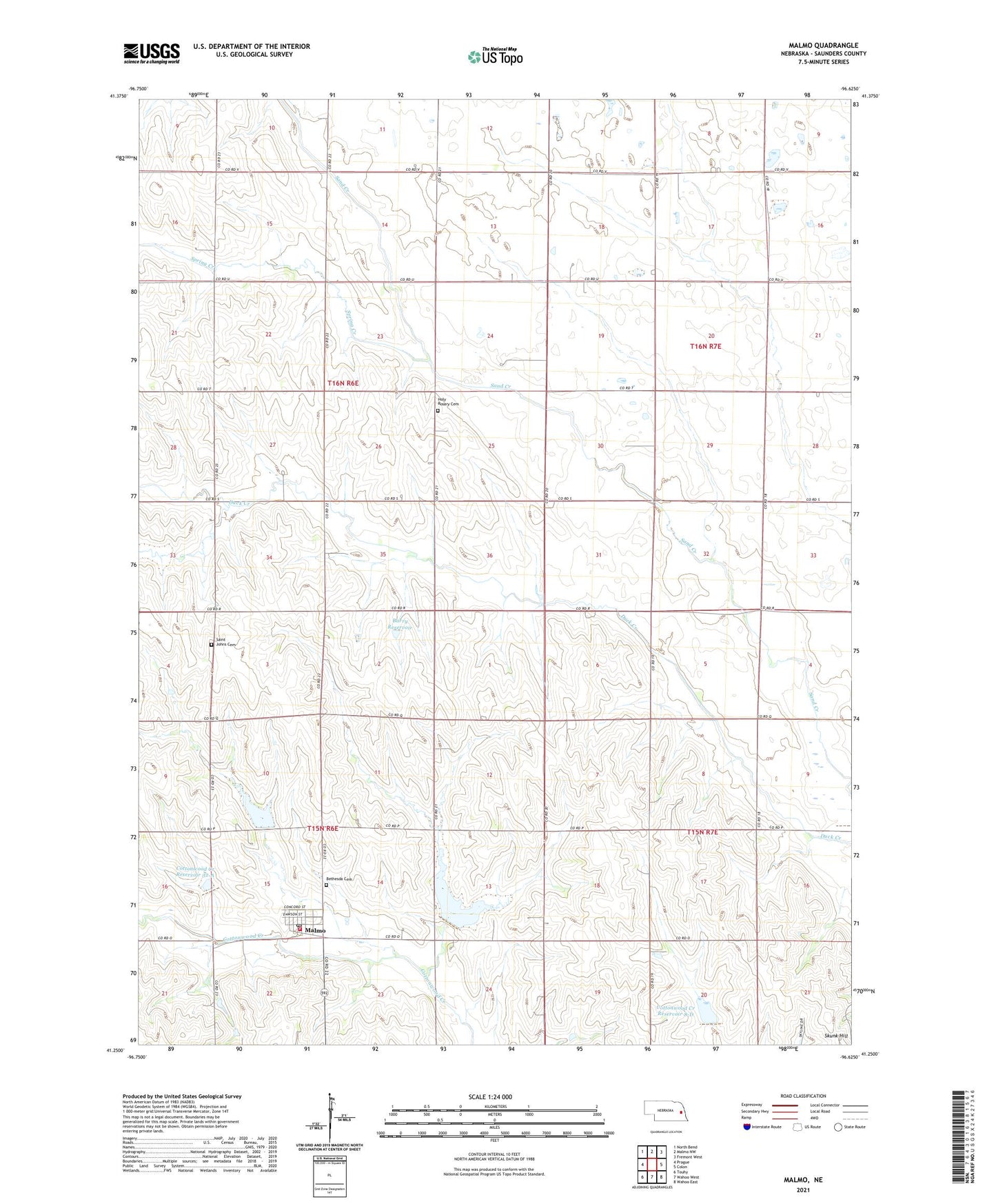
2021 topographic map quadrangle Malmo in the state of Nebraska. Scale: 1:24000. Based on the newly updated USGS 7.5' US Topo map series, this map is in the following counties: Saunders. The map contains contour data, water features, and other items you are used to seeing on USGS maps, but also has updated roads and other features. This is the next generation of topographic maps. Printed on high-quality waterproof paper with UV fade-resistant inks.
Quads adjacent to this one:
West: Prague
Northwest: North Bend
North: Malmo NW
Northeast: Fremont West
East: Colon
Southeast: Wahoo East
South: Wahoo West
Southwest: Touhy
Contains the following named places: Barry Dam, Barry Reservoir, Bethesda Cemetery, Cottonwood Creek Dam 32-A, Cottonwood Creek Dam 8-D, Cottonwood Creek Reservoir 32-A, Cottonwood Creek Reservoir 8-D, Edensburg Lutheran Church, Holy Rosary Cemetery, Malmo, Malmo Fire Department, Malmo Post Office, Malmo Public School, Saint Johns Cemetery, Sand Creek Public School, School Number 26, School Number 61, School Number 75, Skunk Hill, Spring Creek, Township of Douglas, Township of Mariposa, Village of Malmo, ZIP Code: 68040