MyTopo
North Bend Nebraska US Topo Map
Couldn't load pickup availability
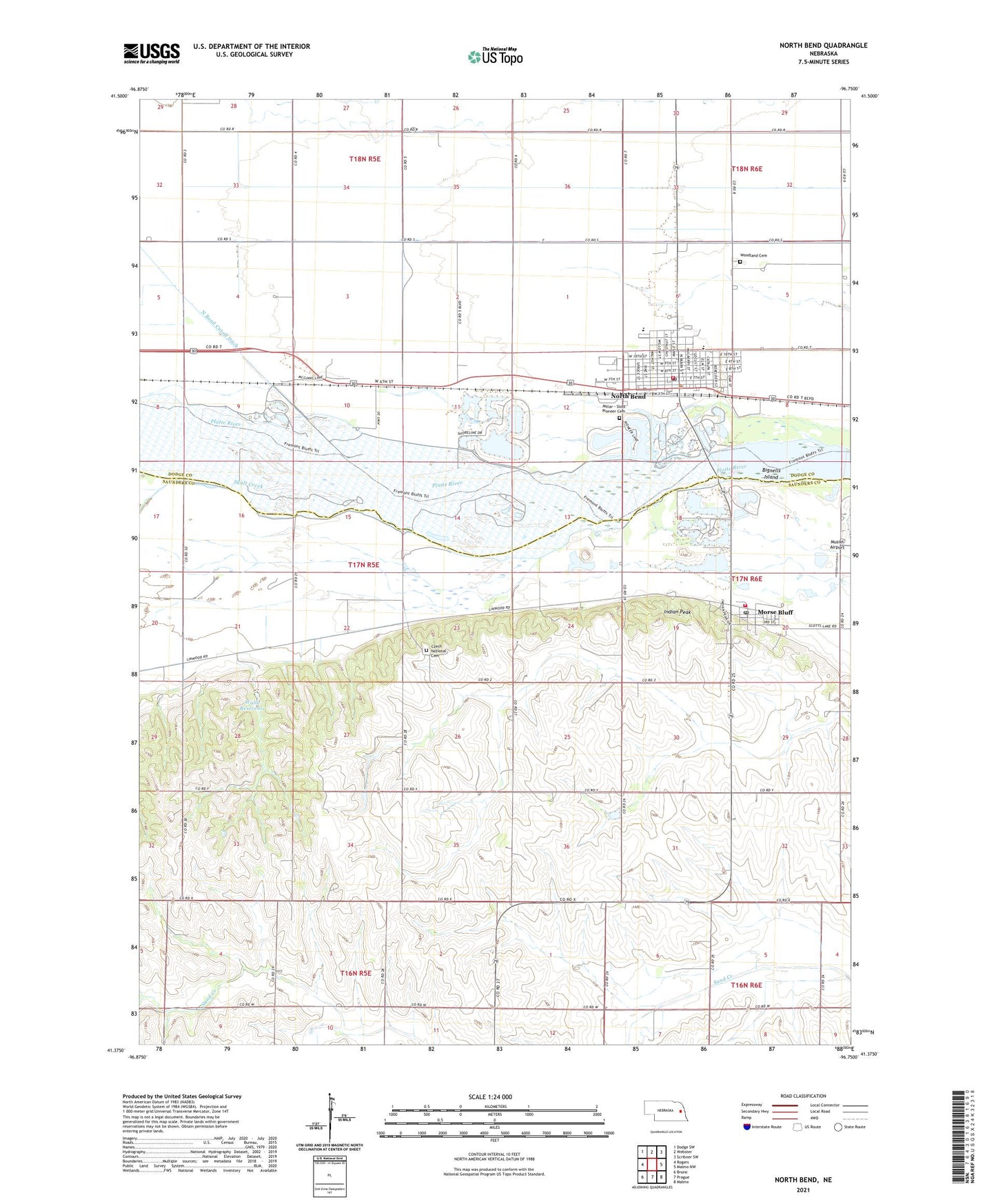
2021 topographic map quadrangle North Bend in the state of Nebraska. Scale: 1:24000. Based on the newly updated USGS 7.5' US Topo map series, this map is in the following counties: Saunders, Dodge. The map contains contour data, water features, and other items you are used to seeing on USGS maps, but also has updated roads and other features. This is the next generation of topographic maps. Printed on high-quality waterproof paper with UV fade-resistant inks.
Quads adjacent to this one:
West: Rogers
Northwest: Dodge SW
North: Webster
Northeast: Scribner SW
East: Malmo NW
Southeast: Malmo
South: Prague
Southwest: Bruno
This map covers the same area as the classic USGS quad with code o41096d7.
Contains the following named places: Bignells Island, Birchwood Manor, City of North Bend, Czech National Cemetery, First Methodist Church, Franklin Post Office, Franklin-Cotterell Greens, Indian Peak, Millar - Sloss Pioneer Cemetery, Millar-Sloss Pioneer Cemetery Historical Marker, Morse Bluff, Morse Bluff District 14 School, Morse Bluff Post Office, Morse Bluff Volunteer Fire Department, Musiel Airport, North Bend, North Bend Central Junior-Senior High School, North Bend City Park, North Bend Cutoff Ditch, North Bend Dental Clinic, North Bend Elementary School, North Bend Fire Department, North Bend Golf Course, North Bend Grain Company Elevator, North Bend Post Office, North Bend Public Library, Prairie Hill School, Sacred Heart Church, Saint Charles Borromeo Catholic Church, Saint Georges Church, Saint Peters Lutheran Church, School Number 54, School Number 77, Skull Creek, Township of Bohemia, United Presbyterian Church, Village of Morse Bluff, Walla Dam, Walla Reservoir, Woodland Cemetery, ZIP Code: 68648