MyTopo
Nehawka Nebraska US Topo Map
Couldn't load pickup availability
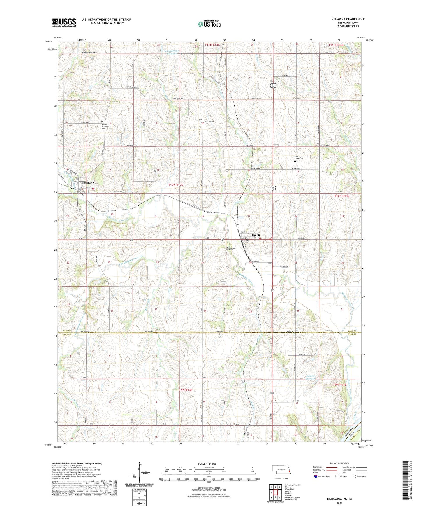
2021 topographic map quadrangle Nehawka in the state of Nebraska. Scale: 1:24000. Based on the newly updated USGS 7.5' US Topo map series, this map is in the following counties: Cass, Otoe, Fremont. The map contains contour data, water features, and other items you are used to seeing on USGS maps, but also has updated roads and other features. This is the next generation of topographic maps. Printed on high-quality waterproof paper with UV fade-resistant inks.
Quads adjacent to this one:
West: Avoca
Northwest: Weeping Water NE
North: Murray
Northeast: Rock Bluff
East: McPaul
Southeast: Nebraska City
South: Nebraska City NW
Southwest: Dunbar
This map covers the same area as the classic USGS quad with code o40095g8.
Contains the following named places: Big Slough, Buck Cemetery, Coal Creek, Conestoga Elementary School, East Union Cemetery, Giles Public School, Haveman Grain Company Elevator, Johnson Dam, Johnson Reservoir, Liberty Election Precinct, Mount Pleasant Cemetery, Nehawka, Nehawka Election Precinct, Nehawka Farmers Cooperative Company Elevator, Nehawka Post Office, Nehawka Public Library, Nehawka Rescue Squad, Nehawka Rural Fire Department, North Branch Weeping Water Creek, Schlichtemeier Dam, Schlichtemeier Reservoir, South Branch Weeping Water Creek, Taylor School, Township of East Rock Bluff, Township of Liberty, Township of Nehawka, Tyson Creek, Unadilla Volunteer Fire and Rescue, Union, Union Post Office, Union School, Union Volunteer Fire and Rescue, United Methodist Church, Village of Nehawka, Village of Union, Washington School, Weeping Water Creek, West Chute, Wolf Creek, ZIP Code: 68455