MyTopo
McPaul Iowa US Topo Map
Couldn't load pickup availability
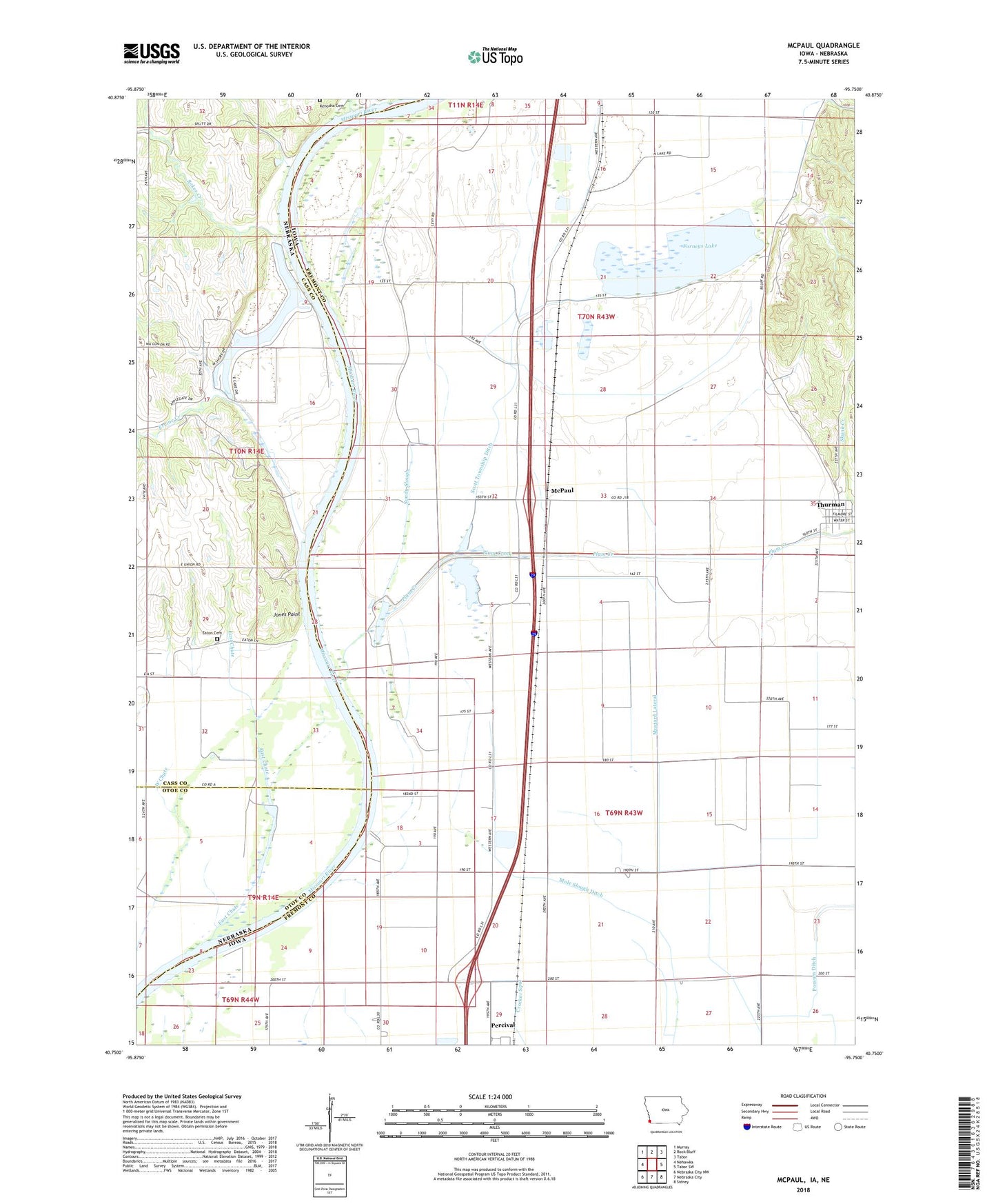
2022 topographic map quadrangle McPaul in the states of Iowa, Nebraska. Scale: 1:24000. Based on the newly updated USGS 7.5' US Topo map series, this map is in the following counties: Fremont, Cass, Otoe. The map contains contour data, water features, and other items you are used to seeing on USGS maps, but also has updated roads and other features. This is the next generation of topographic maps. Printed on high-quality waterproof paper with UV fade-resistant inks.
Quads adjacent to this one:
West: Nehawka
Northwest: Murray
North: Rock Bluff
Northeast: Tabor
East: Tabor SW
Southeast: Sidney
South: Nebraska City
Southwest: Nebraska City NW
Contains the following named places: Buchanan Post Office, Cleveland Post Office, East Chute, Eaton Cemetery, Ervine Creek, Ervine School, Eureka, Forneys Lake, Forneys Lake State Wildlife Management Area, Jones Point, Kenosha Cemetery, Kings Church, McPaul, McPaul Post Office, McPaul State Wildlife Management Area, Mule Slough Ditch, Mustard Lateral, Percival Census Designated Place, Percival State Wildlife Management Area, Plum Creek, Plum Creek Ditch, Possum Ditch, Rakes Creek, Sandy Slough, Scott State Wildlife Management Area, Scott Township Ditch, Skunk Creek, Township of Scott, Wa Con-Da Lake, ZIP Code: 51654