MyTopo
Murray Nebraska US Topo Map
Couldn't load pickup availability
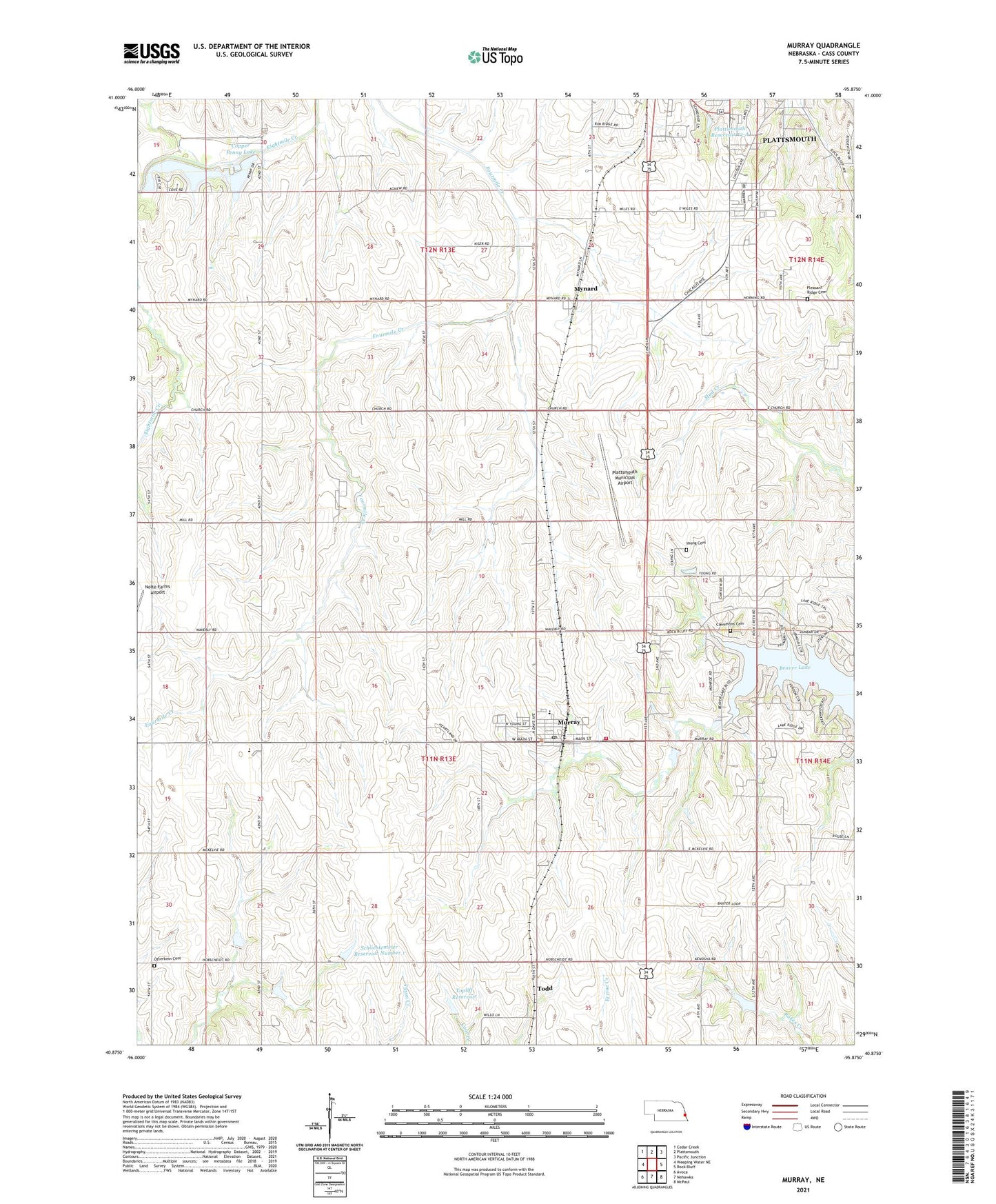
2021 topographic map quadrangle Murray in the state of Nebraska. Scale: 1:24000. Based on the newly updated USGS 7.5' US Topo map series, this map is in the following counties: Cass. The map contains contour data, water features, and other items you are used to seeing on USGS maps, but also has updated roads and other features. This is the next generation of topographic maps. Printed on high-quality waterproof paper with UV fade-resistant inks.
Quads adjacent to this one:
West: Weeping Water NE
Northwest: Cedar Creek
North: Plattsmouth
Northeast: Pacific Junction
East: Rock Bluff
Southeast: McPaul
South: Nehawka
Southwest: Avoca
This map covers the same area as the classic USGS quad with code o40095h8.
Contains the following named places: Ameck School, Beaver Lake, Clemmons Cemetery, Cole Airport, Conestoga Elementary School, Conestoga High School, Copper Penny Lake, Copper Penny Lake Dam, Coral Creek, Cottonwood School, Detention Dam 12-A, Detention Dam 18-A, Eightmile Grove School, Internal Medicine Associates, Jean School, Lewiston School, Little Brick School, Murray, Murray Christian Church, Murray Post Office, Murray Presbyterian Church, Murray Rescue Squad, Murray Rural Fire District, Mynard, Mynard Liberty United Methodist Church, Mynard Post Office, Nehawka Farmers Co-op Elevator, New Hope Community Church, New Hope School, Nolte Farms Airport, Otterbein Cemetery, Plattsmouth Baptist Church, Plattsmouth Municipal Airport, Plattsmouth Reservoir 12-A, Plattsmouth Reservoir 18-A, Pleasant Ridge Cemetery, Roberts Mobile Home Court, Rock Creek School, Schlichtemeier Dam Number 1, Schlichtemeier Reservoir Number 1, School Number 2, South Side Mobile Home Park, Three Grove Post Office, Todd, Topliff Dam, Topliff Reservoir, Village of Murray, West Rock Bluff Election Precinct, W-M Dam, W-M Lake, Young Cemetery, ZIP Codes: 68048, 68409