MyTopo
Norfolk NE Nebraska US Topo Map
Couldn't load pickup availability
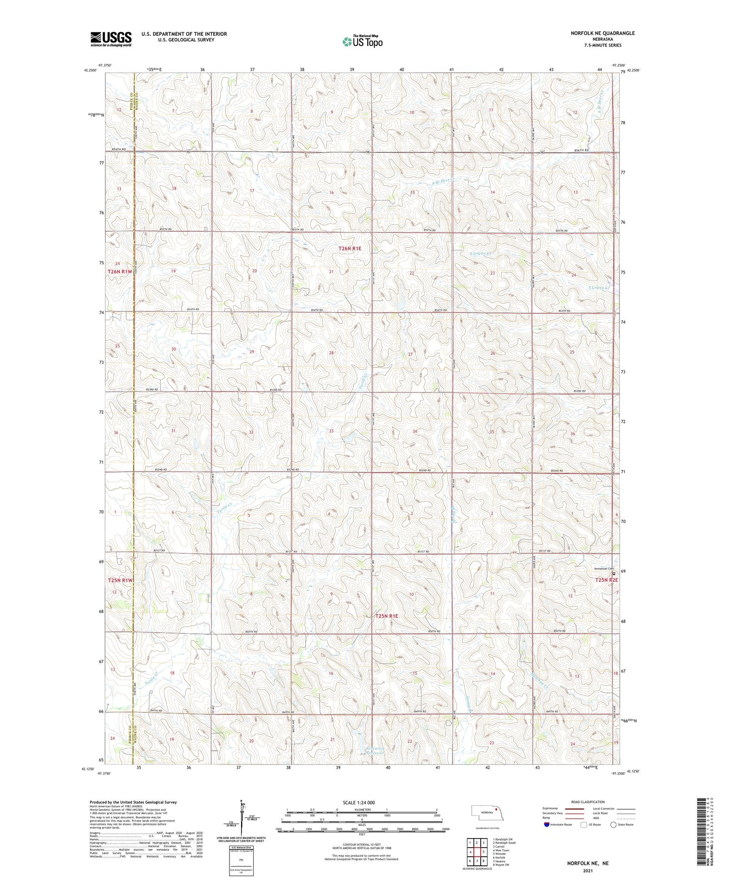
2021 topographic map quadrangle Norfolk NE in the state of Nebraska. Scale: 1:24000. Based on the newly updated USGS 7.5' US Topo map series, this map is in the following counties: Wayne, Pierce. The map contains contour data, water features, and other items you are used to seeing on USGS maps, but also has updated roads and other features. This is the next generation of topographic maps. Printed on high-quality waterproof paper with UV fade-resistant inks.
Quads adjacent to this one:
West: Wee Town
Northwest: Randolph SW
North: Randolph South
Northeast: Carroll
East: Winside
Southeast: Wayne SW
South: Hoskins
Southwest: Norfolk
Contains the following named places: Apex, Bellview School, Garfield Center School, Garfield Election Precinct, Hoskins Election Precinct, Immanuel Cemetery, Immanuel Church, KXNE-FM (Norfolk), KXNE-TV (Norfolk), Scheurich Dam, Scheurich Reservoir, School Number 77, Township of Garfield, Township of Hoskins, Zion Church, ZIP Code: 68740