MyTopo
Odencranze Table South Nebraska US Topo Map
Couldn't load pickup availability
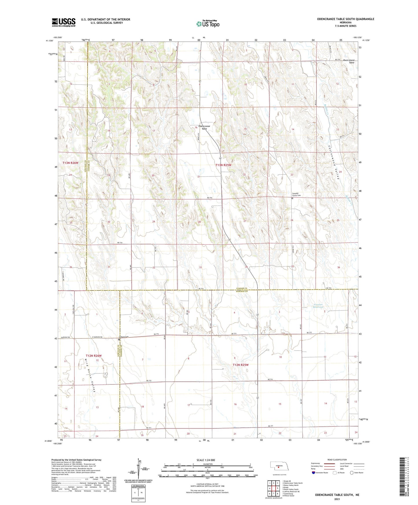
2021 topographic map quadrangle Odencranze Table South in the state of Nebraska. Scale: 1:24000. Based on the newly updated USGS 7.5' US Topo map series, this map is in the following counties: Custer, Dawson, Lincoln. The map contains contour data, water features, and other items you are used to seeing on USGS maps, but also has updated roads and other features. This is the next generation of topographic maps. Printed on high-quality waterproof paper with UV fade-resistant inks.
Quads adjacent to this one:
West: Brady
Northwest: Brady NE
North: Odencranze Table North
Northeast: Roten Valley North
East: Roten Valley South
Southeast: Willow Island
South: Gothenburg
Southwest: Jeffrey Reservoir NE
This map covers the same area as the classic USGS quad with code o41100a2.
Contains the following named places: County Line Public School, Franzen Dam, Franzen Reservoir, Linburg Cemetery, School Number 284, Swedish Grove Cemetery, Township of Wayne, Zion Church, Zion Evangelical Lutheran Church