MyTopo
Roten Valley South Nebraska US Topo Map
Couldn't load pickup availability
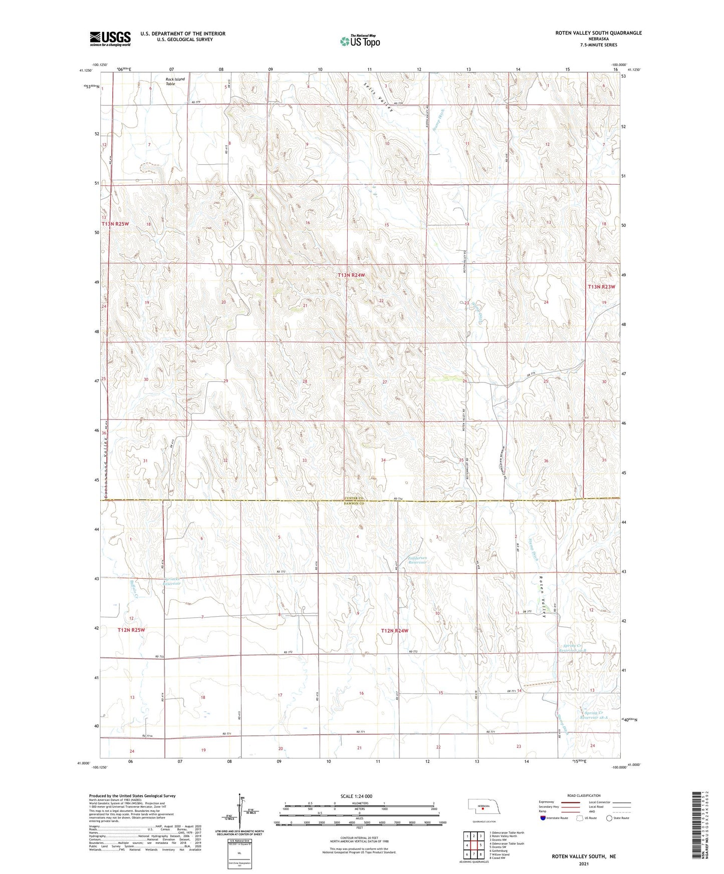
2021 topographic map quadrangle Roten Valley South in the state of Nebraska. Scale: 1:24000. Based on the newly updated USGS 7.5' US Topo map series, this map is in the following counties: Custer, Dawson. The map contains contour data, water features, and other items you are used to seeing on USGS maps, but also has updated roads and other features. This is the next generation of topographic maps. Printed on high-quality waterproof paper with UV fade-resistant inks.
Quads adjacent to this one:
West: Odencranze Table South
Northwest: Odencranze Table North
North: Roten Valley North
Northeast: Oconto NW
East: Oconto SW
Southeast: Cozad NW
South: Willow Island
Southwest: Gothenburg
This map covers the same area as the classic USGS quad with code o41100a1.
Contains the following named places: Cottonwood Valley, Cyriacks Dam, Cyriacks Reservoir, Feddersen Dam, Feddersen Reservoir, German Election Precinct, Roten Valley, Sells Valley, Spring Creek Dam 18-A, Spring Creek Dam 19-B, Spring Creek Reservoir 18-A, Spring Creek Reservoir 19-B, Stump Ditch