MyTopo
Osmond Nebraska US Topo Map
Couldn't load pickup availability
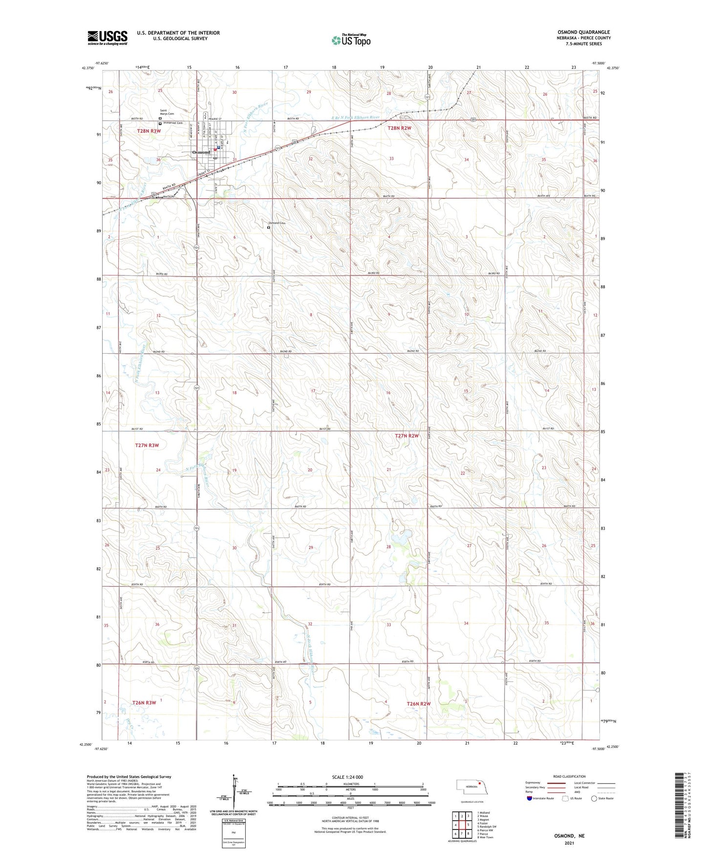
2021 topographic map quadrangle Osmond in the state of Nebraska. Scale: 1:24000. Based on the newly updated USGS 7.5' US Topo map series, this map is in the following counties: Pierce. The map contains contour data, water features, and other items you are used to seeing on USGS maps, but also has updated roads and other features. This is the next generation of topographic maps. Printed on high-quality waterproof paper with UV fade-resistant inks.
Quads adjacent to this one:
West: Foster
Northwest: Midland
North: Wausa
Northeast: Magnet
East: Randolph SW
Southeast: Wee Town
South: Pierce
Southwest: Pierce NW
This map covers the same area as the classic USGS quad with code o42097c5.
Contains the following named places: Battle Creek Farmers Co-op Elevator, City of Osmond, East Branch North Fork Elkhorn River, Immanuel Cemetery, Immanuel Lutheran Church, Immanuel Lutheran Preschool, Logan Election Precinct, Logan Pride School, Osmond, Osmond Ambulance Service, Osmond Cemetery, Osmond City Police Department, Osmond General Hospital, Osmond Post Office, Osmond Public Library, Osmond Public Schools, Osmond Rural Fire Department, Osmond United Methodist Church, Pierce County, Saint Mary Elementary School, Saint Mary of the Seven Dolors Church, Saint Marys Cemetery, Township of Logan, Township of Plum Creek, ZIP Code: 68765