MyTopo
Magnet Nebraska US Topo Map
Couldn't load pickup availability
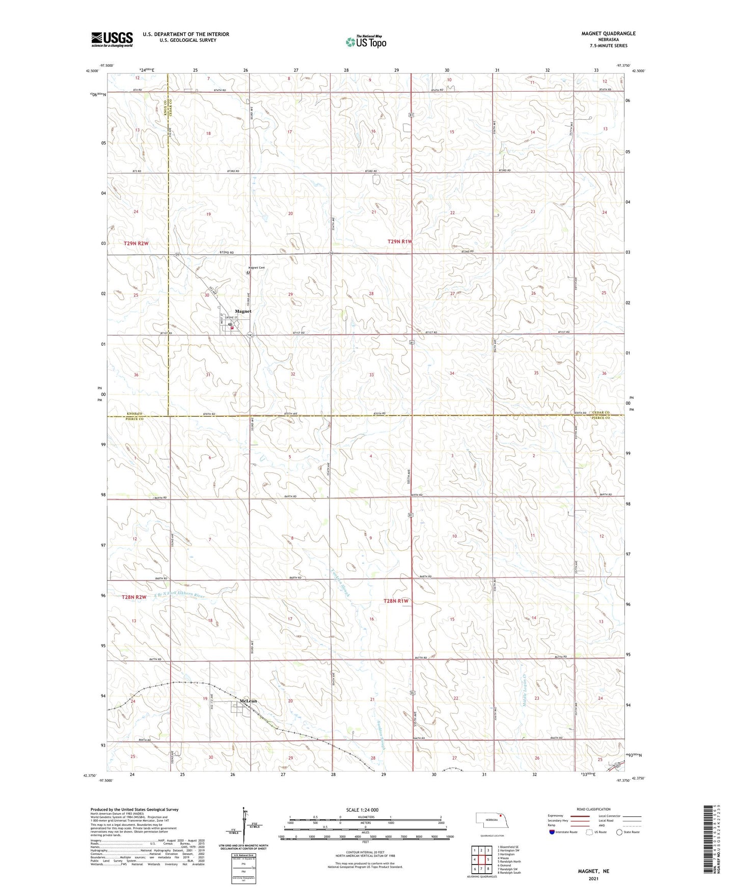
2021 topographic map quadrangle Magnet in the state of Nebraska. Scale: 1:24000. Based on the newly updated USGS 7.5' US Topo map series, this map is in the following counties: Pierce, Cedar, Knox. The map contains contour data, water features, and other items you are used to seeing on USGS maps, but also has updated roads and other features. This is the next generation of topographic maps. Printed on high-quality waterproof paper with UV fade-resistant inks.
Quads adjacent to this one:
West: Wausa
Northwest: Bloomfield SE
North: Hartington SW
Northeast: Hartington
East: Randolph North
Southeast: Randolph South
South: Randolph SW
Southwest: Osmond
This map covers the same area as the classic USGS quad with code o42097d4.
Contains the following named places: Eastern Election Precinct, Election Precinct 18, Magnet, Magnet Cemetery, Magnet Christian Church, Magnet Methodist Church, Magnet Post Office, Magnet Town Park, Magnet Volunteer Fire Department, McLean, McLean Post Office, Tri County Feed and Grain Incorporated Elevator, Village of Magnet, Village of McLean, ZIP Codes: 68747, 68749