MyTopo
Pierce Nebraska US Topo Map
Couldn't load pickup availability
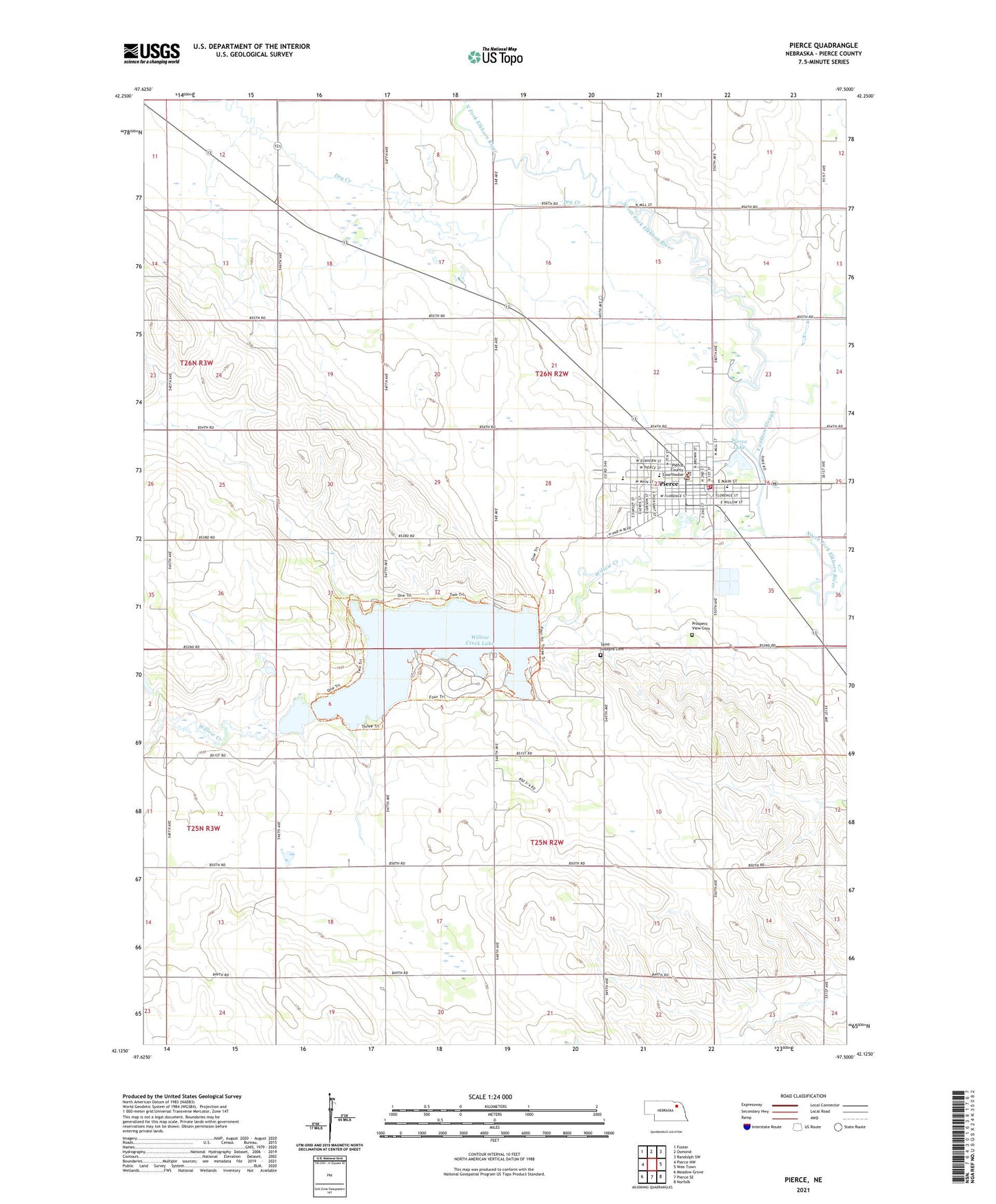
2021 topographic map quadrangle Pierce in the state of Nebraska. Scale: 1:24000. Based on the newly updated USGS 7.5' US Topo map series, this map is in the following counties: Pierce. The map contains contour data, water features, and other items you are used to seeing on USGS maps, but also has updated roads and other features. This is the next generation of topographic maps. Printed on high-quality waterproof paper with UV fade-resistant inks.
Quads adjacent to this one:
West: Pierce NW
Northwest: Foster
North: Osmond
Northeast: Randolph SW
East: Wee Town
Southeast: Norfolk
South: Pierce SE
Southwest: Meadow Grove
This map covers the same area as the classic USGS quad with code o42097b5.
Contains the following named places: Alegent Health Clinic - Pierce, Battle Creek Farmers Co-op Elevator, Christ Lutheran Church, City of Pierce, Cleveland Election Precinct, Cuthills Vineyards, Dry Creek, Gilman Park, Gilman Park Arboretum, Gilman Park Campground, Gilman Park Historical Marker, Old Willow Creek Bridge Historical Marker, Pierce, Pierce Community Golf Course, Pierce County Courthouse, Pierce County Fairgrounds, Pierce County Historical Society Museum Complex, Pierce County Sheriff's Office, Pierce Dam, Pierce Dental Office, Pierce Election Precinct, Pierce Elementary School, Pierce Elevator, Pierce High School, Pierce Lake, Pierce Manor Living Center, Pierce Police Department, Pierce Post Office, Pierce Public Library, Pierce Rescue Service, Pierce Volunteer Fire Department, Prospect View Cemetery, Saint Josephs Catholic Church, Saint Josephs Cemetery, School Number 55, School Number 56, School Number 72, School Number 8, Township of Cleveland, Township of Pierce, United Church of Christ, United Methodist Church, Willow Creek, Willow Creek Lake, Willow Creek State Recreation Area, Willow Creek Trail, Yankton Slough, Zion Lutheran Church, Zion Lutheran School, ZIP Code: 68767