MyTopo
Prague Nebraska US Topo Map
Couldn't load pickup availability
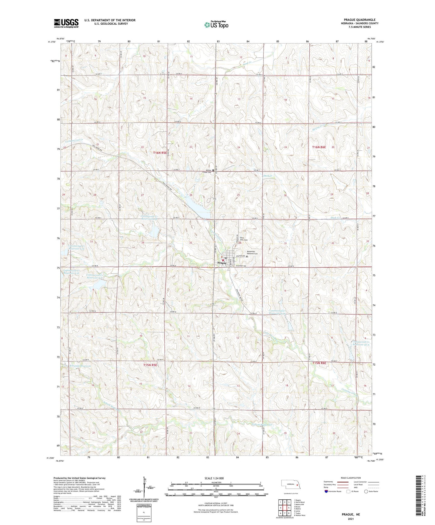
2021 topographic map quadrangle Prague in the state of Nebraska. Scale: 1:24000. Based on the newly updated USGS 7.5' US Topo map series, this map is in the following counties: Saunders. The map contains contour data, water features, and other items you are used to seeing on USGS maps, but also has updated roads and other features. This is the next generation of topographic maps. Printed on high-quality waterproof paper with UV fade-resistant inks.
Quads adjacent to this one:
West: Bruno
Northwest: Rogers
North: North Bend
Northeast: Malmo NW
East: Malmo
Southeast: Wahoo West
South: Touhy
Southwest: Loma
Contains the following named places: Bohemian National Cemetery, Cottonwood Creek Dam 41-A, Cottonwood Creek Dam 42-A, Cottonwood Creek Dam 6-B, Cottonwood Creek Dam 6-C, Cottonwood Creek Dam 6-D, Cottonwood Creek Dam 6-E, Cottonwood Creek Reservoir 41-A, Cottonwood Creek Reservoir 42-A, Cottonwood Creek Reservoir 6-B, Cottonwood Creek Reservoir 6-C, Cottonwood Creek Reservoir 6-E, Czechland Lake, Czechland Lake Recreation Area, Czechland Lake Trail, Farmers Co-op Elevator, Koranda Dam, Koranda Reservoir, Plasi Church, Prague, Prague Clinic, Prague Post Office, Prague Public Schools, Prague Rescue Squad, Prague Volunteer Fire Department, Presbyterian Church, Rescue, Rescue Post Office, Saint Cyril and Methodius Church, Saint John Cemetery, Saint Johns Catholic Church, Township of Chester, Township of Elk, Village of Prague, Willow Creek Cemetery, Willow Creek Post Office, Willow Creek School, ZIP Code: 68050