MyTopo
Smith Lake Nebraska US Topo Map
Couldn't load pickup availability
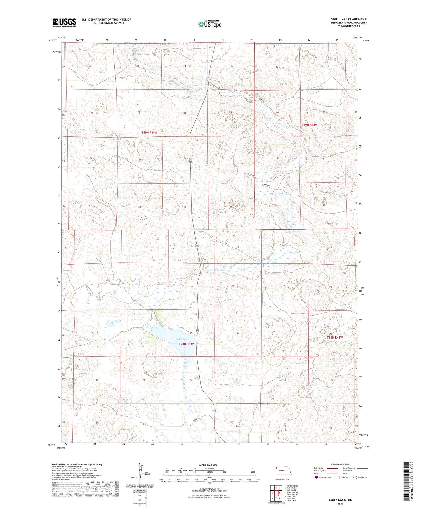
2021 topographic map quadrangle Smith Lake in the state of Nebraska. Scale: 1:24000. Based on the newly updated USGS 7.5' US Topo map series, this map is in the following counties: Sheridan. The map contains contour data, water features, and other items you are used to seeing on USGS maps, but also has updated roads and other features. This is the next generation of topographic maps. Printed on high-quality waterproof paper with UV fade-resistant inks.
Quads adjacent to this one:
West: Skunk Lake NE
Northwest: Hay Springs SE
North: Rushville SW
Northeast: Rushville SE
East: Twin Lakes NE
Southeast: Green Lake
South: Twin Lakes
Southwest: Skunk Lake
This map covers the same area as the classic USGS quad with code o42102d4.
Contains the following named places: Blaine and Blake Beguin Ranch, Bob Beguin Ranch, Boiling Springs Public School, Britt Ranch, Budd Ranch, Grayson, Grayson Post Office, Hinn Ranch, Orr Airport, Orr Ranch, Pine Creek Ranch, School Number 112, School Number 132, School Number 32, Smith Lake, Smith Lake Dam, Smith Lake State Wildlife Management Area