MyTopo
Swedehome Nebraska US Topo Map
Couldn't load pickup availability
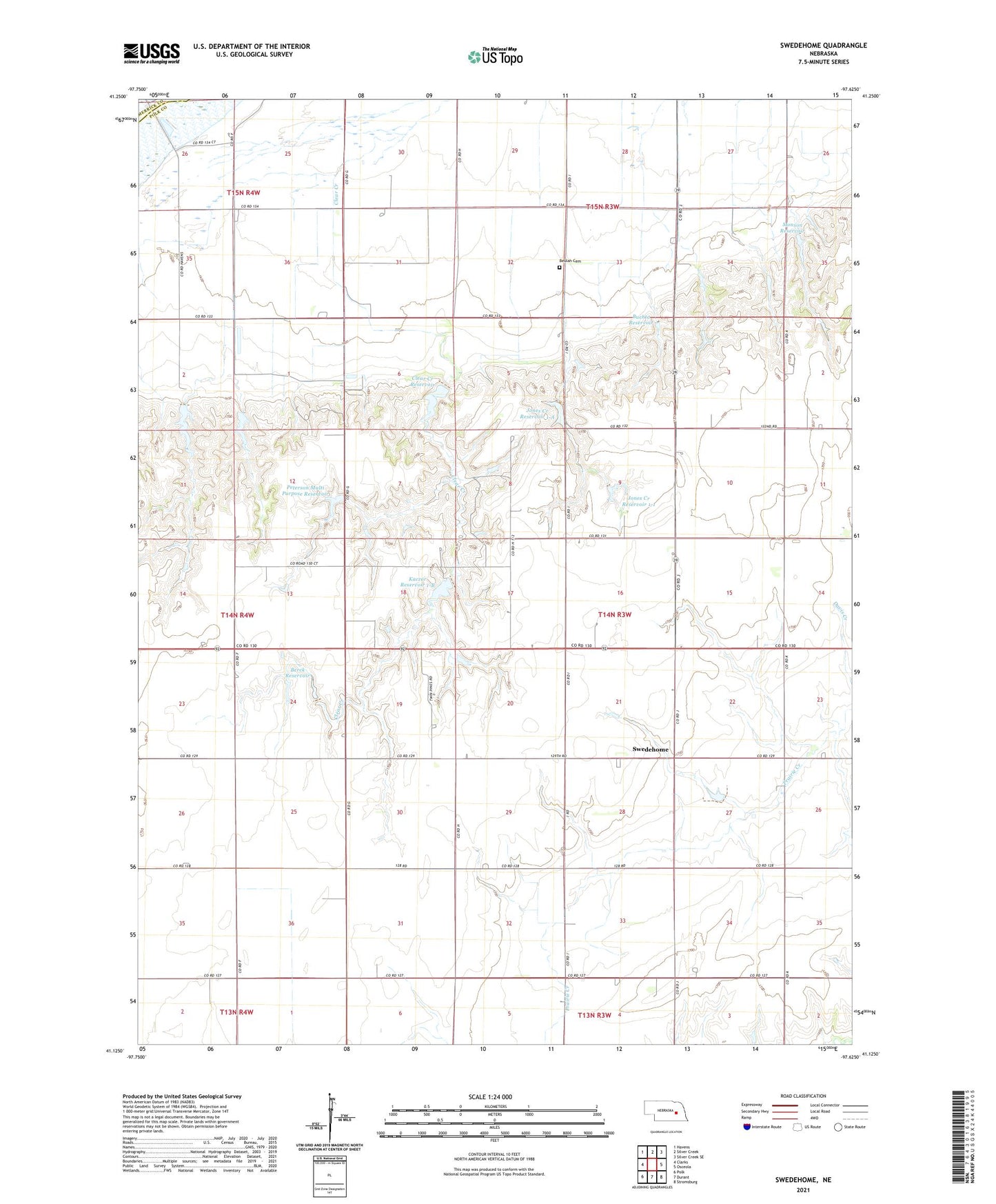
2021 topographic map quadrangle Swedehome in the state of Nebraska. Scale: 1:24000. Based on the newly updated USGS 7.5' US Topo map series, this map is in the following counties: Polk, Merrick. The map contains contour data, water features, and other items you are used to seeing on USGS maps, but also has updated roads and other features. This is the next generation of topographic maps. Printed on high-quality waterproof paper with UV fade-resistant inks.
Quads adjacent to this one:
West: Clarks
Northwest: Havens
North: Silver Creek
Northeast: Silver Creek SE
East: Osceola
Southeast: Stromsburg
South: Durant
Southwest: Polk
Contains the following named places: Berck Detention Dam 1-C, Berck Reservoir, Beulah Cemetery, Buchta Dam, Buchta Reservoir, Clear Creek Dam, Clear Creek Reservoir, Detention Dam 1-A, Fairview Church, Grade Stabilization Dam 1-1, Jones Creek Reservoir 1-1, Jones Creek Reservoir 1-A, Kaczor Detention Dam 1-B, Kaczor Reservoir 1-B, Monson Dam, Monson Reservoir, Peterson Multi Purpose Dam, Peterson Multi Purpose Reservoir, Platte Election Precinct, School Number 28, School Number 49, School Number 7, Swedehome, Swedehome Post Office, Swedish Lutheran Church, Township of Platte