
MyTopo
Stromsburg Nebraska US Topo Map
Couldn't load pickup availability
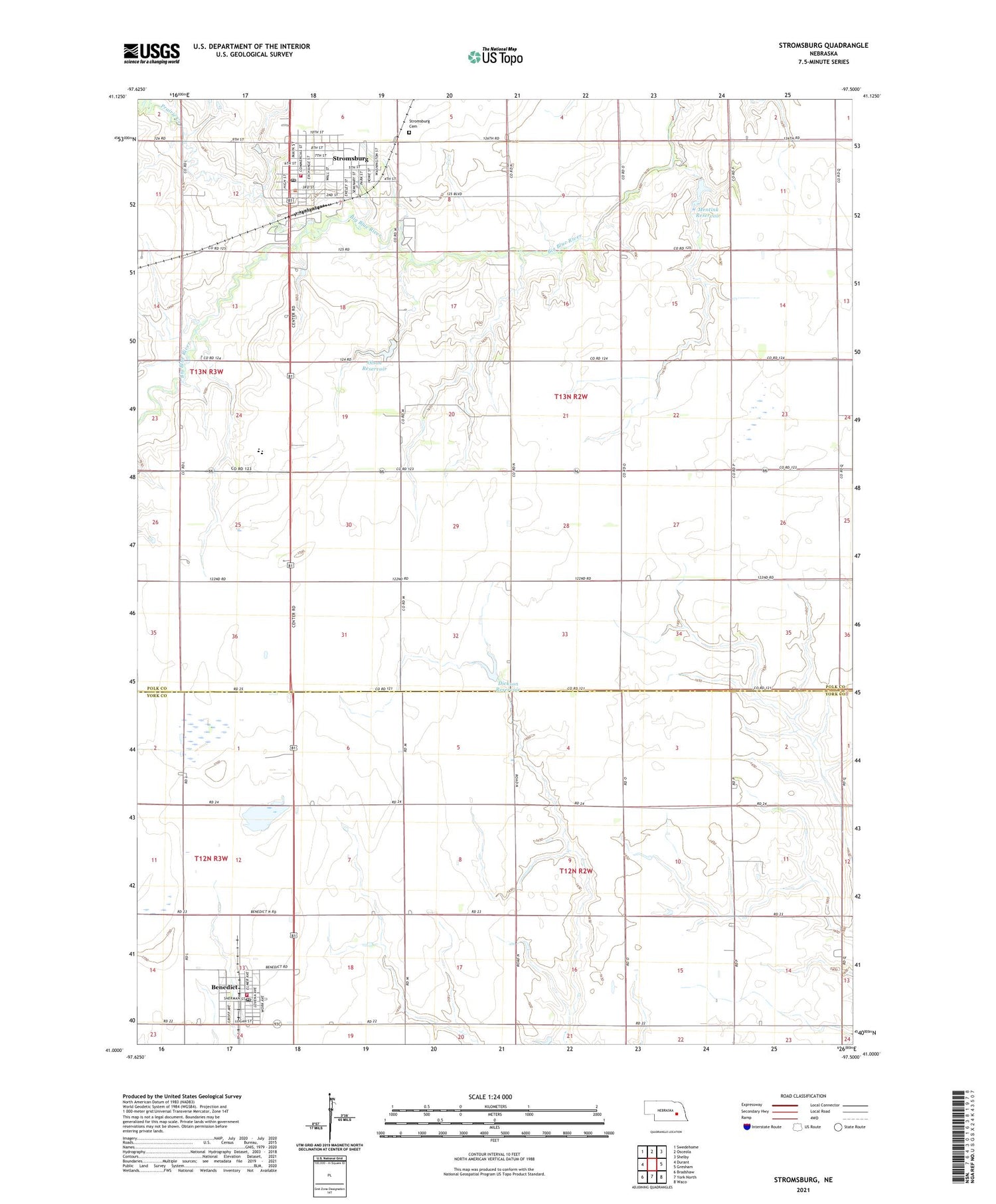
2021 topographic map quadrangle Stromsburg in the state of Nebraska. Scale: 1:24000. Based on the newly updated USGS 7.5' US Topo map series, this map is in the following counties: Polk, York. The map contains contour data, water features, and other items you are used to seeing on USGS maps, but also has updated roads and other features. This is the next generation of topographic maps. Printed on high-quality waterproof paper with UV fade-resistant inks.
Quads adjacent to this one:
West: Durant
Northwest: Swedehome
North: Osceola
Northeast: Shelby
East: Gresham
Southeast: Waco
South: York North
Southwest: Bradshaw
This map covers the same area as the classic USGS quad with code o41097a5.
Contains the following named places: Benedict, Benedict Post Office, Benedict Public Schools, Benedict Volunteer Fire Department, Buckley Park, Buckley Park Campground, City of Stromsburg, Dickson Dam, Dickson Reservoir, Don E Nordberg Field, East Stromsburg Election Precinct, Evangelical Covenant Church, Evangelical Free Church, Living Word Church, Mentink Dam, Mentink Reservoir, Midwest Covenant Home, Olson Dam, Olson Reservoir, Prairie Creek, Prairie Creek Family Medicine, Salem Lutheran Church, Security Grain Company Incorporated Elevator, Stromsburg, Stromsburg Baptist Church, Stromsburg Cemetery, Stromsburg Elementary School, Stromsburg High School, Stromsburg Medical Clinic, Stromsburg Police Department, Stromsburg Post Office, Stromsburg Public Library, Stromsburg Trail, Stromsburg Volunteer Fire and Rescue, Thayer Election Precinct, The Swede Capital of Nebraska Historical Marker, Township of Stromsburg, Township of Thayer, United Co-op Elevator, United Co-op Incorporated Elevator, United Methodist Church, Village of Benedict, ZIP Code: 68666


