MyTopo
Waco Nebraska US Topo Map
Couldn't load pickup availability
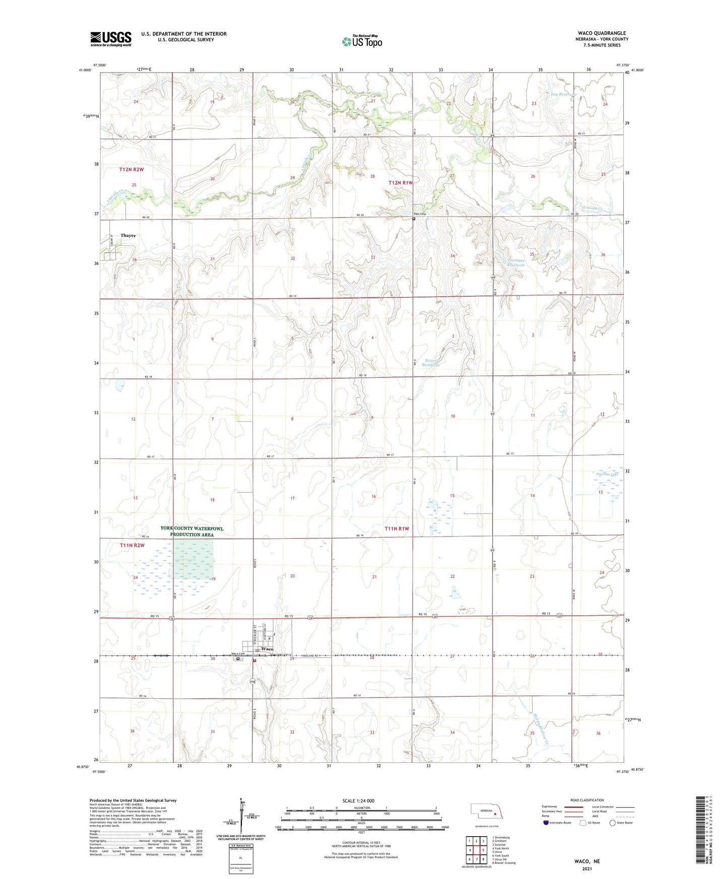
2021 topographic map quadrangle Waco in the state of Nebraska. Scale: 1:24000. Based on the newly updated USGS 7.5' US Topo map series, this map is in the following counties: York. The map contains contour data, water features, and other items you are used to seeing on USGS maps, but also has updated roads and other features. This is the next generation of topographic maps. Printed on high-quality waterproof paper with UV fade-resistant inks.
Quads adjacent to this one:
West: York North
Northwest: Stromsburg
North: Gresham
Northeast: Surprise
East: Utica
Southeast: Beaver Crossing
South: Utica SW
Southwest: York South
Contains the following named places: Bethel Lutheran Church, Dey Dam, Dey Reservoir, Emmanuel Church, Farmers Co-op Association Elevator, Nebraska Lutheran High School, Palo Cemetery, Peters Dam, Peters Reservoir, Spikerush State Wildlife Management Area, Thayer, Thayer Post Office, Tonniges Dam, Tonniges Reservoir, Township of Waco, Village of Thayer, Village of Waco, Waco, Waco Election Precinct, Waco Federal Waterfowl Production Area, Waco Golf Course, Waco Municipal Park, Waco Peace Lutheran Church, Waco Post Office, Waco Volunteer Fire Department, Wildcat Creek, ZIP Code: 68460