MyTopo
Utica Nebraska US Topo Map
Couldn't load pickup availability
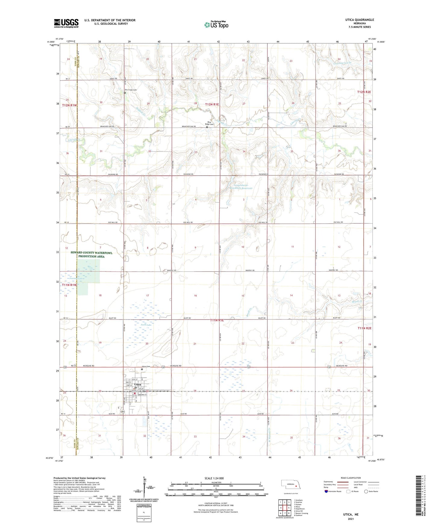
2021 topographic map quadrangle Utica in the state of Nebraska. Scale: 1:24000. Based on the newly updated USGS 7.5' US Topo map series, this map is in the following counties: Seward, York. The map contains contour data, water features, and other items you are used to seeing on USGS maps, but also has updated roads and other features. This is the next generation of topographic maps. Printed on high-quality waterproof paper with UV fade-resistant inks.
Quads adjacent to this one:
West: Waco
Northwest: Gresham
North: Surprise
Northeast: Ulysses
East: Staplehurst
Southeast: Goehner
South: Beaver Crossing
Southwest: Utica SW
This map covers the same area as the classic USGS quad with code o40097h3.
Contains the following named places: Blue Ridge Cemetery, Centennial Public Schools, Community Care of Utica, Conns Park, Dry Creek Cemetery, Election Precinct E, Farmers Cooperative Business Association Elevator, Freeman Lake, Freeman Lake Federal Waterfowl Production Area, Langenheim-Brackham Dam, Langenheim-Brackham Reservoir, Memorial Clinic of Utica, North Ball Park, North Lake, North Lake Basin State Wildlife Management Area, Saint Patrick Catholic Church, Saint Paul Lutheran Church, Saint Paul Lutheran School, Seward County Waterfowl Production Area, South Ball Park, Township E, United Methodist Church, Utica, Utica Cemetery, Utica Post Office, Utica Volunteer Fire and Rescue, Village of Utica, ZIP Code: 68456