MyTopo
Gresham Nebraska US Topo Map
Couldn't load pickup availability
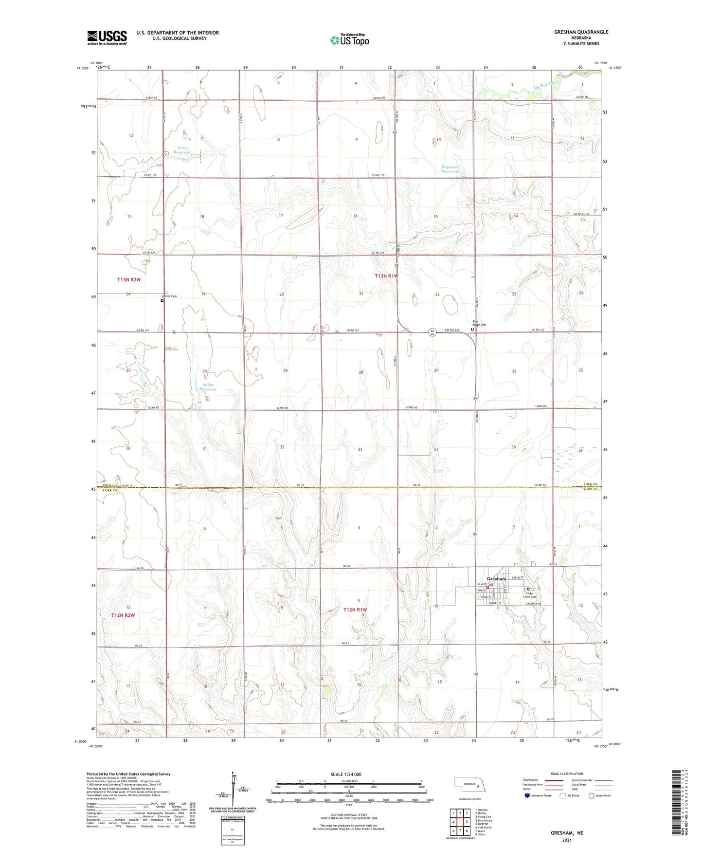
2021 topographic map quadrangle Gresham in the state of Nebraska. Scale: 1:24000. Based on the newly updated USGS 7.5' US Topo map series, this map is in the following counties: Polk, York. The map contains contour data, water features, and other items you are used to seeing on USGS maps, but also has updated roads and other features. This is the next generation of topographic maps. Printed on high-quality waterproof paper with UV fade-resistant inks.
Quads adjacent to this one:
West: Stromsburg
Northwest: Osceola
North: Shelby
Northeast: Rising City
East: Surprise
Southeast: Utica
South: Waco
Southwest: York North
This map covers the same area as the classic USGS quad with code o41097a4.
Contains the following named places: Blue Ridge Cemetery, Cedar Lawn Cemetery, Don Alt Dam, Farmers Co-op Business Association Elevator, Gresham, Gresham Municipal Park, Gresham Post Office, Gresham Public Library, Gresham Rural Fire and Rescue, Hoffer Cemetery, Hopwood Dam, Hopwood Reservoir, Miller Dam, Miller Reservoir, Moab Heliport, Saint Peters Lutheran Church, Stewart Election Precinct, Torell Dam, Torell Reservoir, Township of Hackberry, Township of Stewart, Village of Gresham, Wayland Church, ZIP Code: 68367