MyTopo
Wildcat Mountain Nebraska US Topo Map
Couldn't load pickup availability
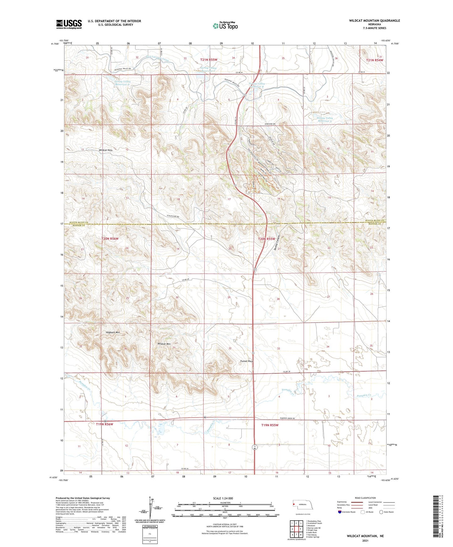
2021 topographic map quadrangle Wildcat Mountain in the state of Nebraska. Scale: 1:24000. Based on the newly updated USGS 7.5' US Topo map series, this map is in the following counties: Banner, Scotts Bluff. The map contains contour data, water features, and other items you are used to seeing on USGS maps, but also has updated roads and other features. This is the next generation of topographic maps. Printed on high-quality waterproof paper with UV fade-resistant inks.
Quads adjacent to this one:
West: Murray Lake NE
Northwest: Roubadeau Pass
North: Scottsbluff South
Northeast: Minatare
East: Wright Gap
Southeast: Indian Springs
South: Harrisburg
Southwest: Gabe Rock
This map covers the same area as the classic USGS quad with code o41103f6.
Contains the following named places: Airdale Dam Number 1, Airdale Reservoir Number 1, Dooley Canyon, Funnel Rock, Gering Valley Dam A, Gering Valley Dam B, Gering Valley Dam C, Gering Valley Dam D, Gering Valley Reservoir A, Gering Valley Reservoir B, Gering Valley Reservoir C, Gering Valley Reservoir D, Henderson Oil Field, Hogback Mountain, KCMI-FM (Terrytown), KNEB-FM (Scottsbluff), Post Dam, Post Reservoir, Scott Dam, Scott Reservoir, Wildcat Hills, Wildcat Hills Camping Area, Wildcat Hills Nature Center, Wildcat Hills State Recreation Area, Wildcat Hills Trails, Wildcat Mountain, ZIP Code: 69341