MyTopo
Government Wash Nevada US Topo Map
Couldn't load pickup availability
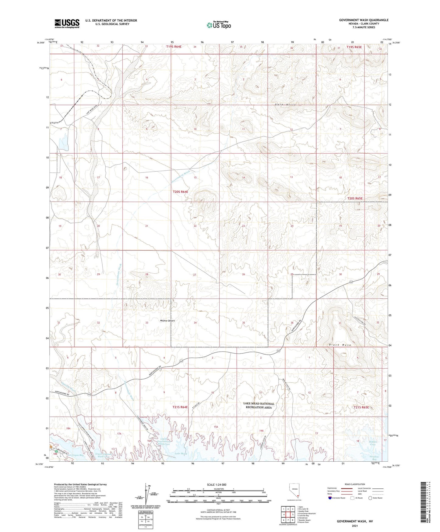
2021 topographic map quadrangle Government Wash in the state of Nevada. Scale: 1:24000. Based on the newly updated USGS 7.5' US Topo map series, this map is in the following counties: Clark. The map contains contour data, water features, and other items you are used to seeing on USGS maps, but also has updated roads and other features. This is the next generation of topographic maps. Printed on high-quality waterproof paper with UV fade-resistant inks.
Quads adjacent to this one:
West: Frenchman Mountain
Northwest: Apex
North: Dry Lake SE
Northeast: Muddy Peak
East: Callville Bay
Southeast: Hoover Dam
South: Boulder Beach
Southwest: Henderson
This map covers the same area as the classic USGS quad with code o36114b7.
Contains the following named places: Black Mesa, Crawdad Cove, Gale Hills, Government Wash, Gypsum Wash, Hidden Cove, Lower Government Wash Cove, Lower Gypsum Wash Cove, Upper Government Wash Cove