MyTopo
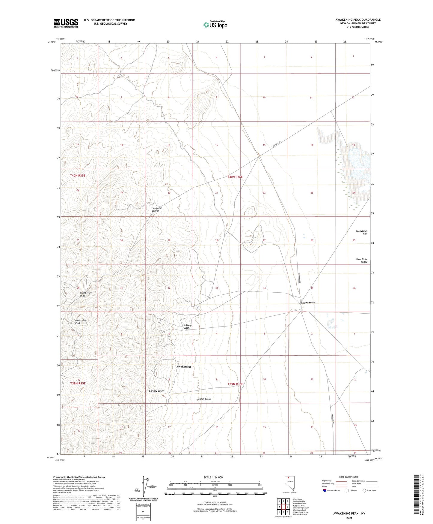
Awakening Peak Nevada US Topo Map
Couldn't load pickup availability
2021 topographic map quadrangle Awakening Peak in the state of Nevada. Scale: 1:24000. Based on the newly updated USGS 7.5' US Topo map series, this map is in the following counties: Humboldt. The map contains contour data, water features, and other items you are used to seeing on USGS maps, but also has updated roads and other features. This is the next generation of topographic maps. Printed on high-quality waterproof paper with UV fade-resistant inks.
Quads adjacent to this one:
West: Jackson Well
Northwest: Sod House
North: Gallagher Flat
Northeast: Andorno Ranch
East: Mud Spring Canyon
Southeast: Bloody Run Peak
South: Silver State Draw
Southwest: Sombrero Peak
This map covers the same area as the classic USGS quad with code o41117c8.
Contains the following named places: Alabama Mine, Awakening, Awakening Mining District, Awakening Peak, Big Bob Number 2 Mine, Daveytown, Gaffney Gulch, Glory Hole Mine, Havalau Mine, Havilah Gulch, Havilah Well, Humboldt Canyon, Humboldt Mine, J S Jones Well, Jackson Well, Jumbo Mine, Ladd Mine, Mayday Mine, Mohawk Mine, Pipes Mine, Sandhill Shaft, Scheelite Mine, Sheelite Mine, Siskiyou Gulch, Siskiyou Mine, Spanish Girl Mine