MyTopo
Silver State Draw Nevada US Topo Map
Couldn't load pickup availability
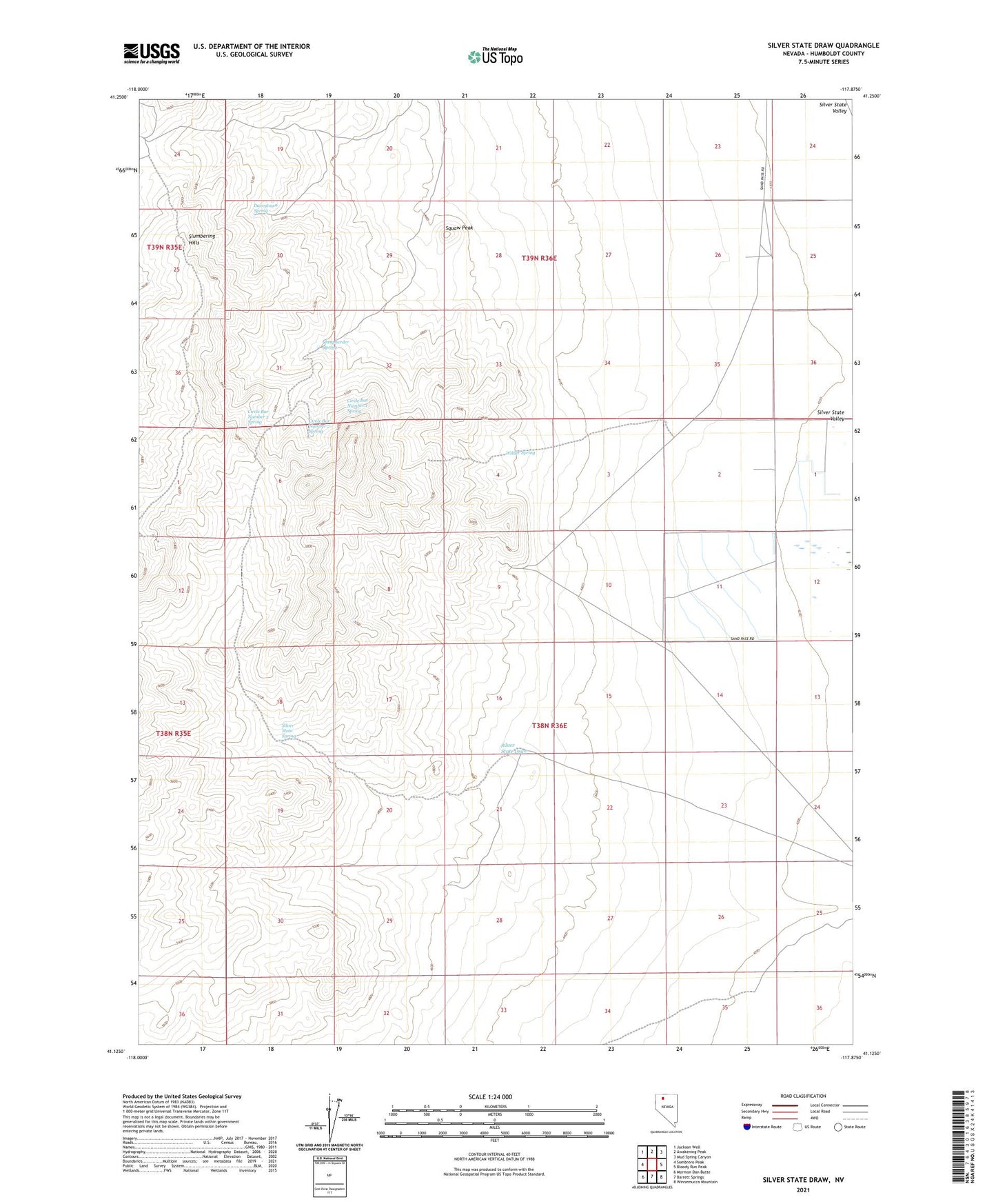
2023 topographic map quadrangle Silver State Draw in the state of Nevada. Scale: 1:24000. Based on the newly updated USGS 7.5' US Topo map series, this map is in the following counties: Humboldt. The map contains contour data, water features, and other items you are used to seeing on USGS maps, but also has updated roads and other features. This is the next generation of topographic maps. Printed on high-quality waterproof paper with UV fade-resistant inks.
Quads adjacent to this one:
West: Sombrero Peak
Northwest: Jackson Well
North: Awakening Peak
Northeast: Mud Spring Canyon
East: Bloody Run Peak
Southeast: Winnemucca Mountain
South: Barrett Springs
Southwest: Mormon Dan Butte
This map covers the same area as the classic USGS quad with code o41117b8.
Contains the following named places: Circle Bar Number 1 Spring, Circle Bar Number 2 Spring, Circle Bar Number 3 Spring, Daveytown Spring, Pickhandle Pass, Sheepherder Spring, Silver State Camp, Silver State Draw, Silver State Mine, Silver State Spring, Slumbering Hills, Squaw Peak, Wilder Spring