MyTopo
Gallagher Flat Nevada US Topo Map
Couldn't load pickup availability
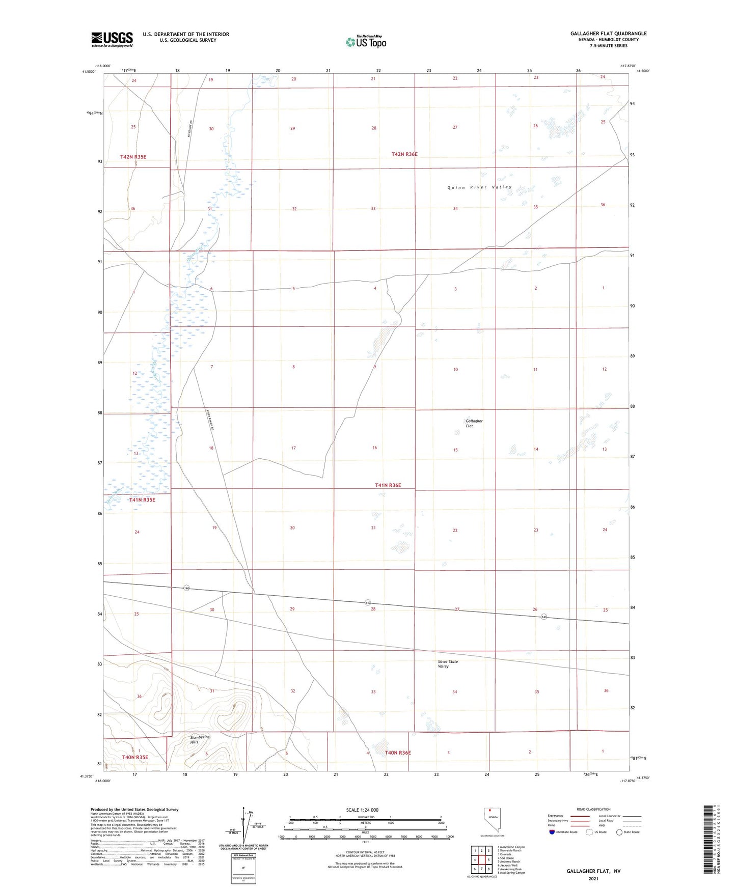
2021 topographic map quadrangle Gallagher Flat in the state of Nevada. Scale: 1:24000. Based on the newly updated USGS 7.5' US Topo map series, this map is in the following counties: Humboldt. The map contains contour data, water features, and other items you are used to seeing on USGS maps, but also has updated roads and other features. This is the next generation of topographic maps. Printed on high-quality waterproof paper with UV fade-resistant inks.
Quads adjacent to this one:
West: Sod House
Northwest: Moonshine Canyon
North: Riverside Ranch
Northeast: Orovada
East: Andorno Ranch
Southeast: Mud Spring Canyon
South: Awakening Peak
Southwest: Jackson Well
This map covers the same area as the classic USGS quad with code o41117d8.
Contains the following named places: Domingo Cabin, Gallagher Flat, Gallagher Well, Hanks Well, Little Windmill, Minor Well, River Ranch, Silver State Valley