MyTopo
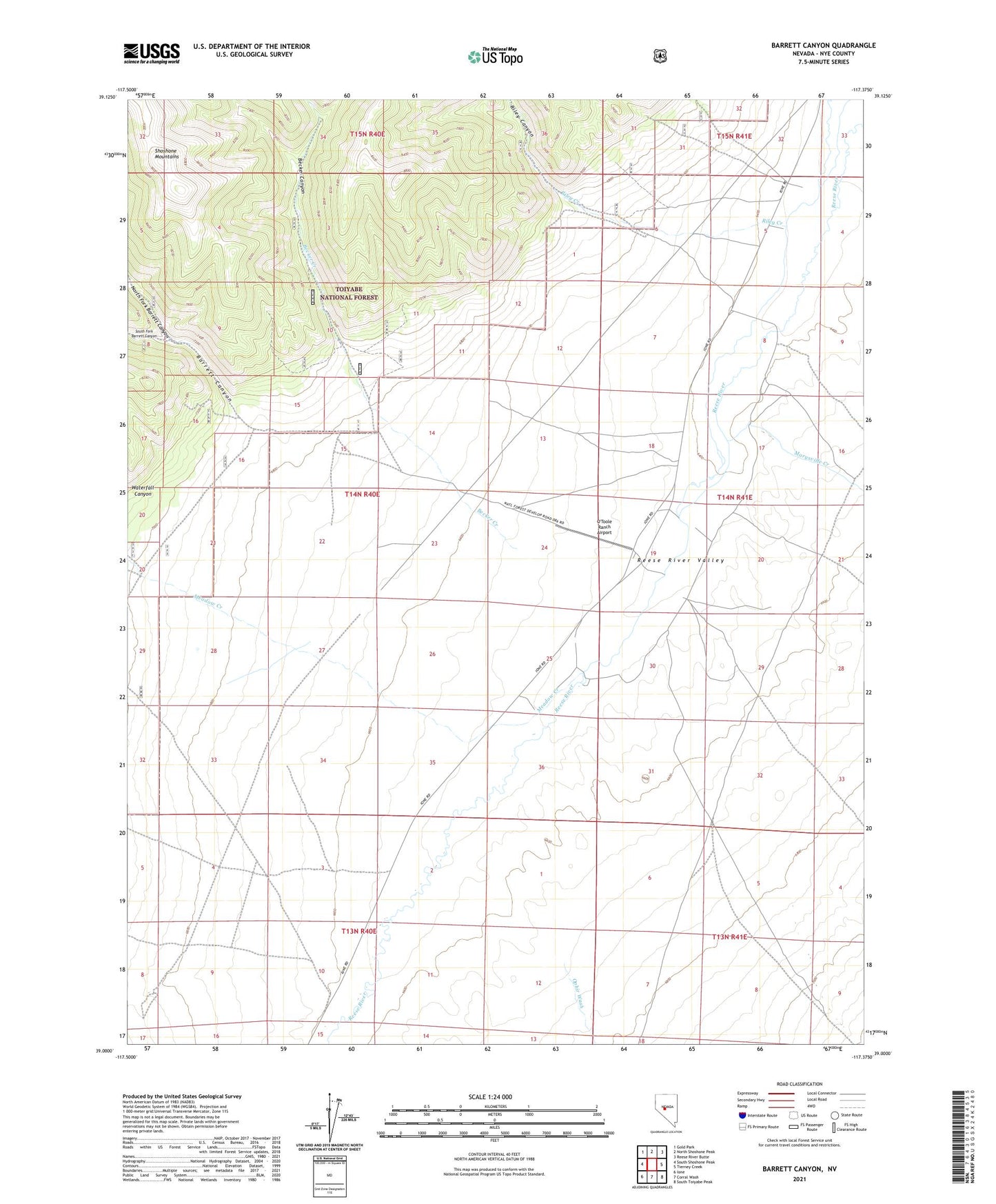
Barrett Canyon Nevada US Topo Map
Couldn't load pickup availability
Also explore the Barrett Canyon Forest Service Topo of this same quad for updated USFS data
2021 topographic map quadrangle Barrett Canyon in the state of Nevada. Scale: 1:24000. Based on the newly updated USGS 7.5' US Topo map series, this map is in the following counties: Nye. The map contains contour data, water features, and other items you are used to seeing on USGS maps, but also has updated roads and other features. This is the next generation of topographic maps. Printed on high-quality waterproof paper with UV fade-resistant inks.
Quads adjacent to this one:
West: South Shoshone Peak
Northwest: Gold Park
North: North Shoshone Peak
Northeast: Reese River Butte
East: Tierney Creek
Southeast: South Toiyabe Peak
South: Corral Wash
Southwest: Ione
This map covers the same area as the classic USGS quad with code o39117a4.
Contains the following named places: Barrett, Barrett Canyon, Barrett Post Office, Becker Canyon, Becker Creek, J F Bowler Ranch, Marysville, Marysville Creek, Meadow Creek, North Fork Barrett Canyon, O'Toole Ranch, O'Toole Ranch Airport, Reese River Post Office, Riley Canyon, Riley Creek, South Fork Barrett Canyon, Ward Mine, Waterfall Canyon