
MyTopo
Becky Peak Nevada US Topo Map
Couldn't load pickup availability
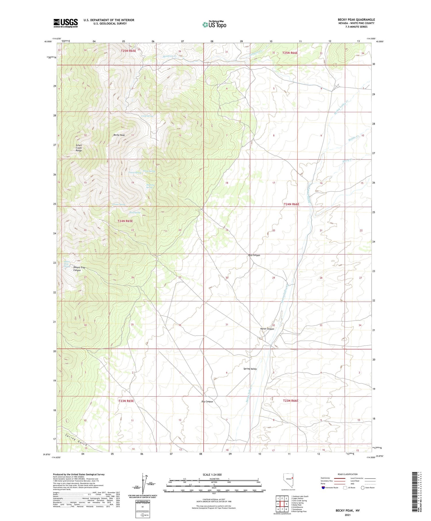
2021 topographic map quadrangle Becky Peak in the state of Nevada. Scale: 1:24000. Based on the newly updated USGS 7.5' US Topo map series, this map is in the following counties: White Pine. The map contains contour data, water features, and other items you are used to seeing on USGS maps, but also has updated roads and other features. This is the next generation of topographic maps. Printed on high-quality waterproof paper with UV fade-resistant inks.
Quads adjacent to this one:
West: Cherry Spring
Northwest: Goshute Lake South
North: Lages Station
Northeast: Chin Creek Spring
East: Baldy Peak
Southeast: Rock Springs Pass
South: Stonehouse
Southwest: Schellbourne
This map covers the same area as the classic USGS quad with code o39114h5.
Contains the following named places: Becky Peak, Becky Peak Wilderness, Box Canyon, Camp Spring, Dolans Trap Canyon, Dolans Trap Spring, Dry Canyon, Gravel Spring, Grouse Spring, Henriod Seeding Well, Horse Canyon, Horse Spring, Middle Creek, Mustang Spring, Sharp Creek, Skull Spring


