MyTopo
Goshute Lake South Nevada US Topo Map
Couldn't load pickup availability
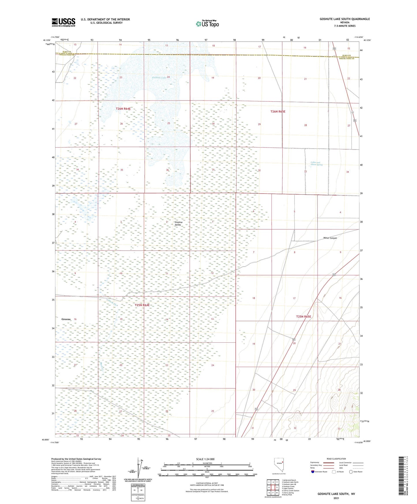
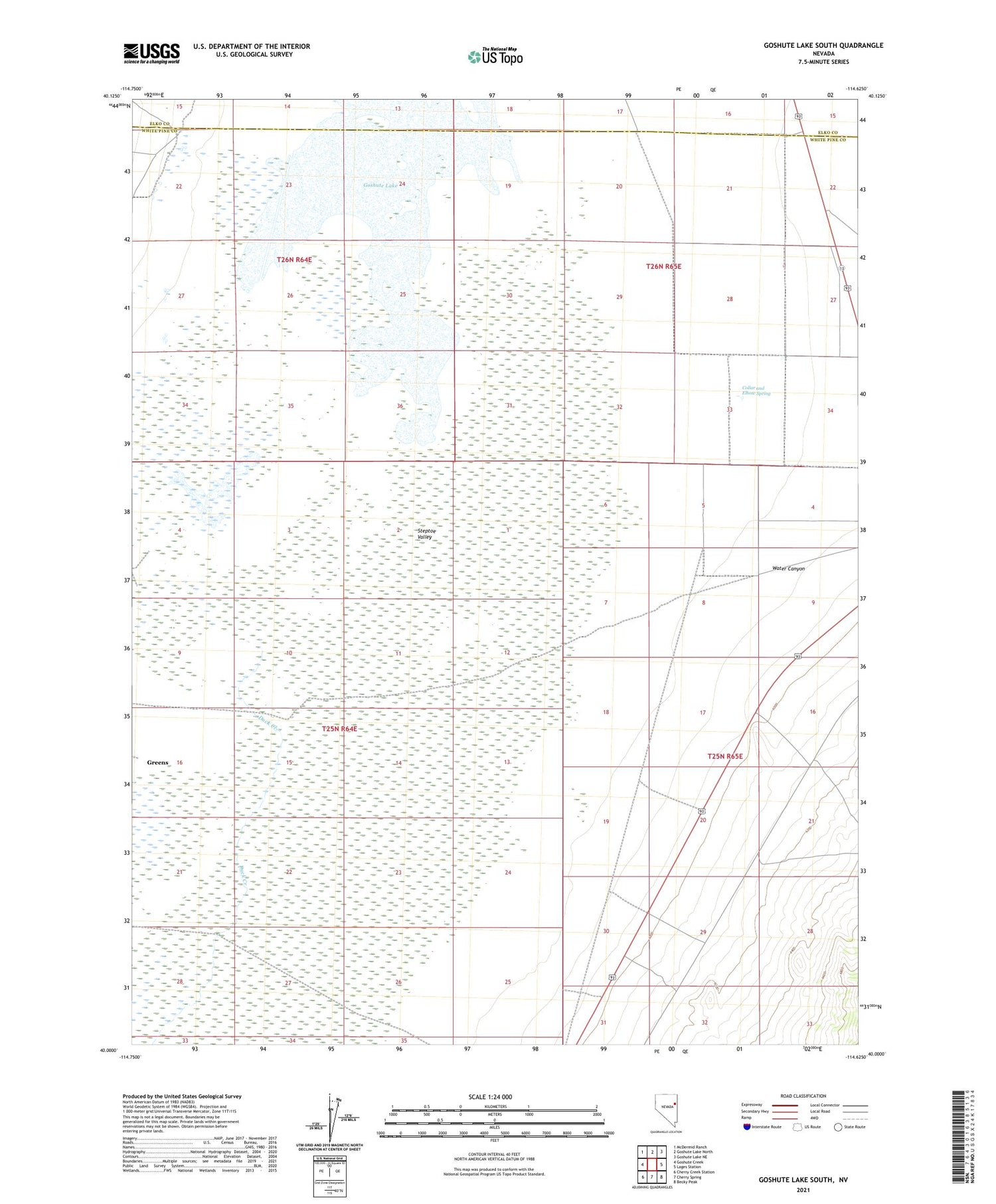
2021 topographic map quadrangle Goshute Lake South in the state of Nevada. Scale: 1:24000. Based on the newly updated USGS 7.5' US Topo map series, this map is in the following counties: White Pine, Elko. The map contains contour data, water features, and other items you are used to seeing on USGS maps, but also has updated roads and other features. This is the next generation of topographic maps. Printed on high-quality waterproof paper with UV fade-resistant inks.
Quads adjacent to this one:
West: Goshute Creek
Northwest: McDermid Ranch
North: Goshute Lake North
Northeast: Goshute Lake NE
East: Lages Station
Southeast: Becky Peak
South: Cherry Spring
Southwest: Cherry Creek Station
This map covers the same area as the classic USGS quad with code o40114a6.
Contains the following named places: Collar and Elbow Spring, Duck Creek, Greens, School House Spring, Warm Springs Reservoir, Water Canyon