MyTopo
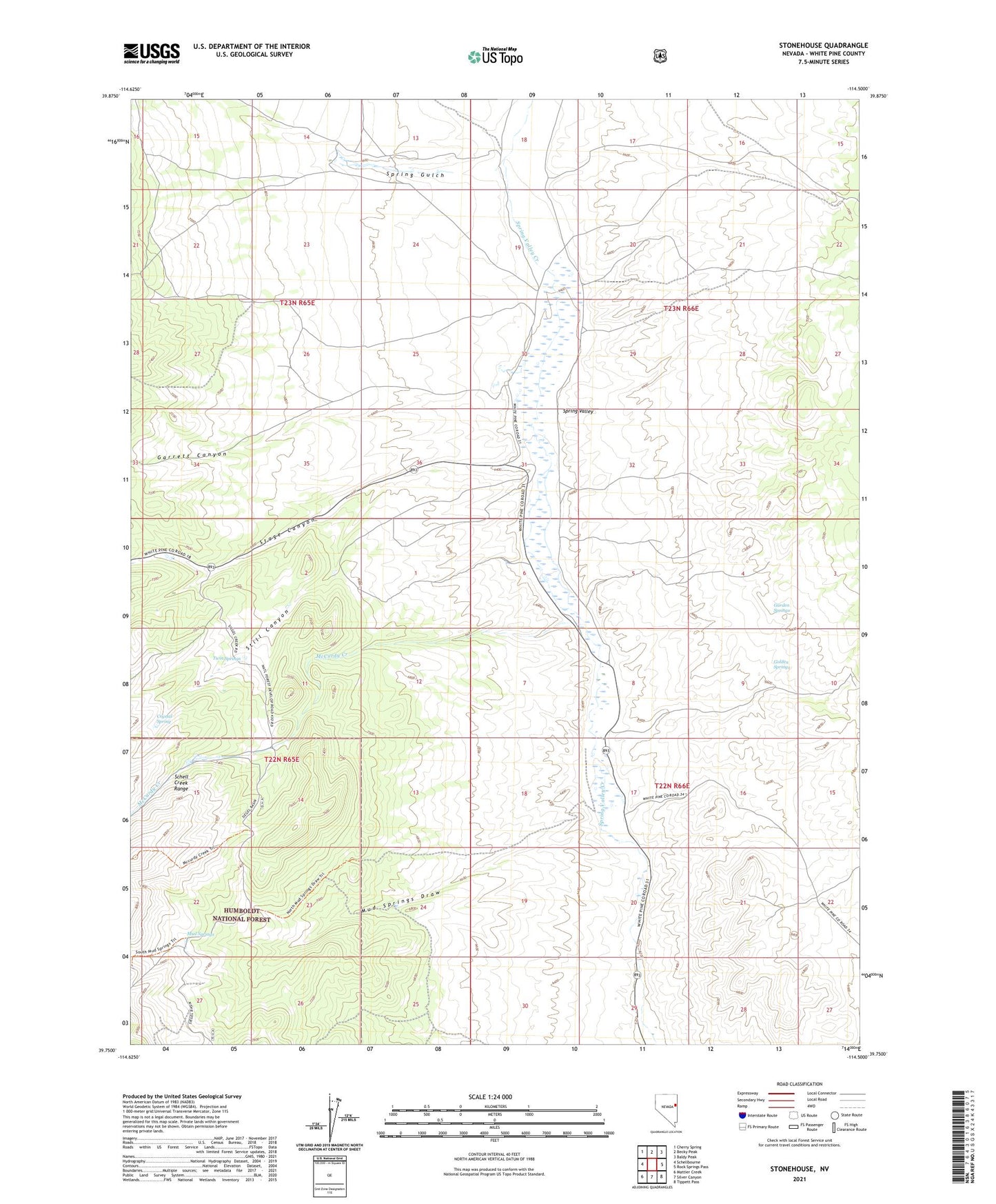
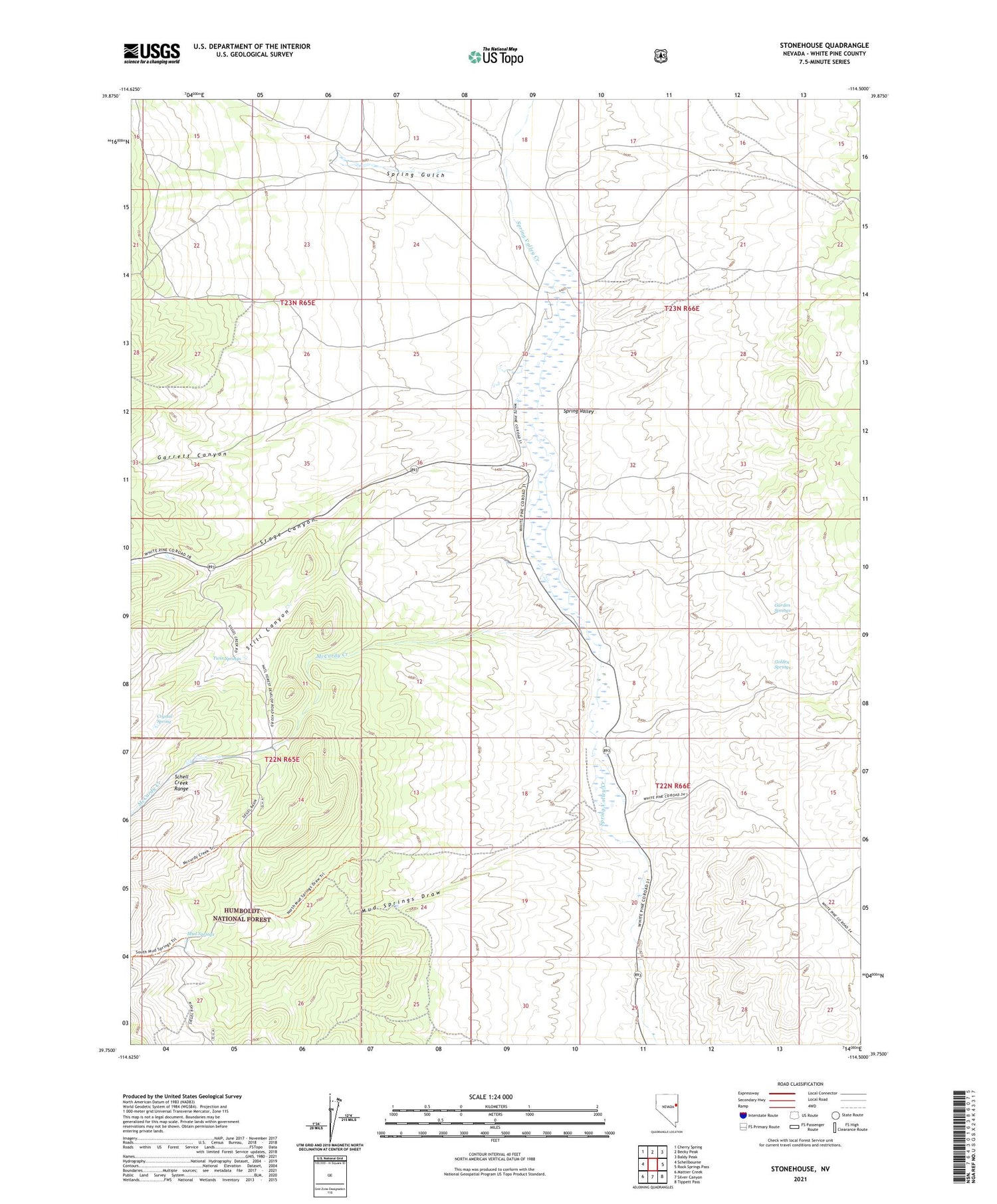
Stonehouse Nevada US Topo Map
Couldn't load pickup availability
Also explore the Stonehouse Forest Service Topo of this same quad for updated USFS data
2021 topographic map quadrangle Stonehouse in the state of Nevada. Scale: 1:24000. Based on the newly updated USGS 7.5' US Topo map series, this map is in the following counties: White Pine. The map contains contour data, water features, and other items you are used to seeing on USGS maps, but also has updated roads and other features. This is the next generation of topographic maps. Printed on high-quality waterproof paper with UV fade-resistant inks.
Quads adjacent to this one:
West: Schellbourne
Northwest: Cherry Spring
North: Becky Peak
Northeast: Baldy Peak
East: Rock Springs Pass
Southeast: Tippett Pass
South: Silver Canyon
Southwest: Mattier Creek
This map covers the same area as the classic USGS quad with code o39114g5.
Contains the following named places: Bews Ranch, Boundy Ranch, Crystal Spring, D Henriod Ranch, Garden Springs, Garrett Canyon, Golden Springs, McCurdy Creek, Mud Springs, Mud Springs Draw, Rosenlund Ranch, Seigel Administrative Site, Spring Gulch, Spring Gulch Ranch, Spring Valley Station, Stage Canyon, Still Canyon, Stonehouse, Twin Springs