MyTopo
Blue Eagle Springs NE Nevada US Topo Map
Couldn't load pickup availability
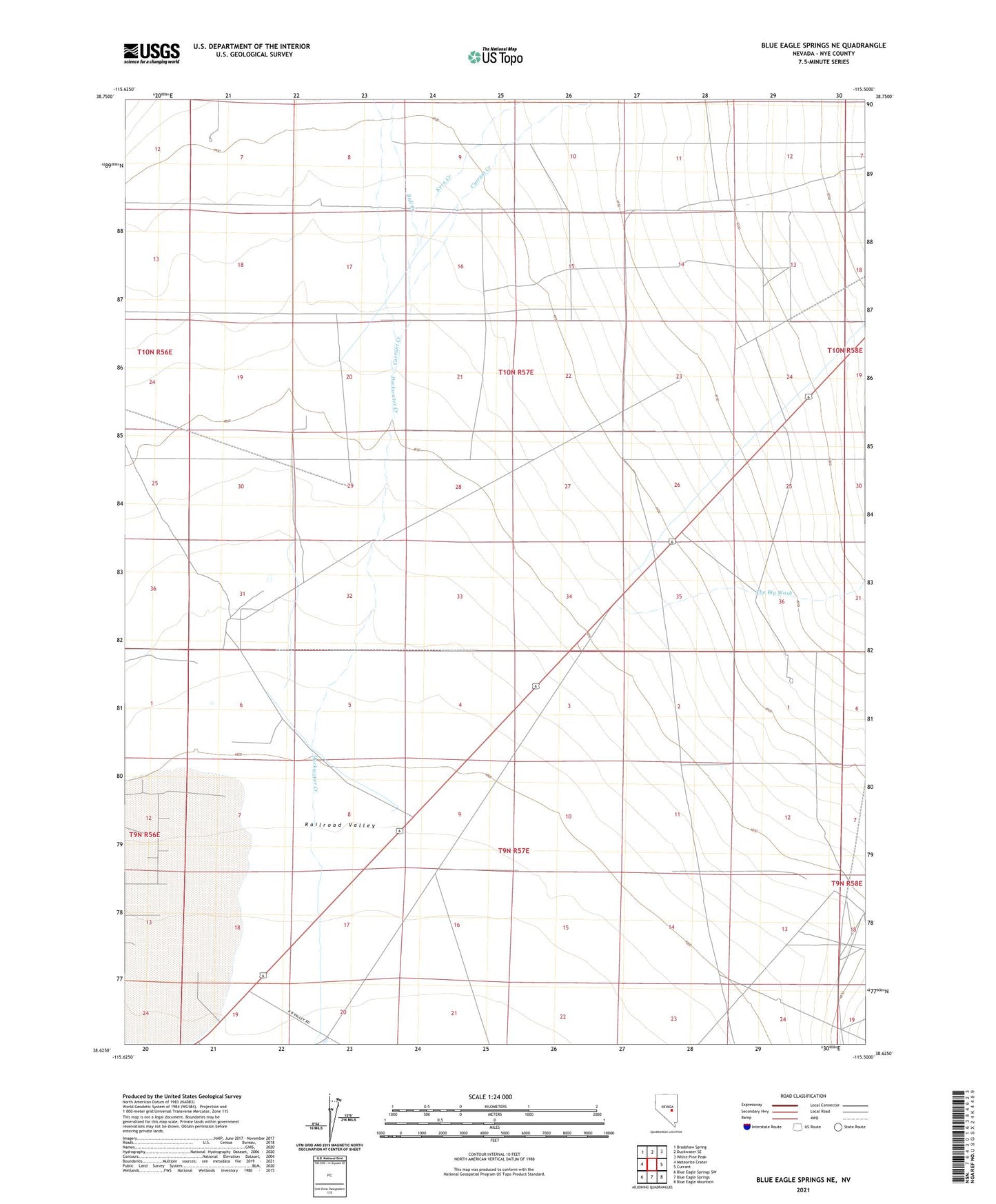
2021 topographic map quadrangle Blue Eagle Springs NE in the state of Nevada. Scale: 1:24000. Based on the newly updated USGS 7.5' US Topo map series, this map is in the following counties: Nye. The map contains contour data, water features, and other items you are used to seeing on USGS maps, but also has updated roads and other features. This is the next generation of topographic maps. Printed on high-quality waterproof paper with UV fade-resistant inks.
Quads adjacent to this one:
West: Meteorite Crater
Northwest: Bradshaw Spring
North: Duckwater SE
Northeast: White Pine Peak
East: Currant
Southeast: Blue Eagle Mountain
South: Blue Eagle Springs
Southwest: Blue Eagle Springs SW
This map covers the same area as the classic USGS quad with code o38115f5.
Contains the following named places: Allred, Allred Post Office, Blue Eagle Well, Bull Creek, Currant Creek, Kern Creek, The Big Wash